Maine

Millinocket Marathon and Half - Race Review

Now that hiking season has been winding down I find myself with more time for running again.  I'm super excited to be back into the swing of things and this coming year I've got some lofty goals set for myself, starting with a New Years' Eve Ultramarathon!  While this is still primarily a hiking blog, much like last winter you'll start to see some running posts from me again.  This particular post will be a race review of the Millinocket Marathon and Half Marathon I ran back on 12-10-16 in Millinocket, Maine.  

Many of you already know that Millinocket is dear to my heart.  The final Appalachian Trail town, I spent six days here on my 2012 AT thru hike.  in 2013, I moved to Maine to work in the Appalachian Trail Lodge for an entire hiking season.  In 2015, when I got sick on the Finger Lakes Trail, NoKey and I went to spend a week in town during the Fourth of July between the end of that hike and the start of our Long Trail thru hike.  While NoKey was able to visit town back in August of this year when he did a canoe trip on the Allagash, I wasn't able to visit this year.  That's why I was so happy to be able to participate in the Millinocket Marathon and Half - a free race thrown by Gary Allen on behalf of the town.  The stipulation for this race is a simple one - this free Boston Qualifier event is only free in the fact that you pay no race fee to enter.  Whatever you would spend on a race of this caliber you are encouraged to spend in town at one of MANY local events.  If you can't find anything to buy, Gary recommended you tip 100% at every meal to add up to the total of a race.  

The day before the race - posing at the finish! 

The day before the race - posing at the finish! 

We drove up to Maine over the period of three days.  Stopping in northern Virginia and Portland, Maine before heading up to Millinocket.  When we arrived in town on December 9th it was very, VERY clear the entire town was behind the idea of this race.  It was refreshing to me to see that everyone was so excited about it.  There were banners everywhere welcoming runners.  Each local business in town had a raffle going on.  We immediate drove straight to Ruthie's Hotel Terrace and checked in before heading out to our favorite restaurant - Angelo's.  NoKey got a slice and a Schlitz before we headed over to the Press Conference.  The conference was only about 40 minutes and took place at Design Lab - in the old Wreath Factory - and had a couple of people speaking.  Most notable of these people for me was Mike Wardian - a name most runners know.  We then visited the craft fair taking place at Sterns High School which also doubled as the "expo" for the race.  I had so much fun buying Christmas gifts that I actually forgot the reason we were there was to pick up our bibs!  We actually got a swag bag too containing balsamic vinegar, some samples of natural products from Vitamin Shoppe, and some free Gu from Bangor Savings Bank.  And here I was not expecting to get ANYTHING other than a bib for a free race.  

IMG_1778.JPG

The morning of the race we are able to sleep in, which is so nice!  We headed over to the snowmobile club to get a cheap AYCE pancake breakfast and headed back to the hotel to wallow in pancake bliss.  Around 9:30 we headed downtown for the race.  The temperature had risen above zero, but the windchill still read -8.  The start/finish line area had a great party atmosphere and two active bonfire pits - one of which was made by Pelletier's Manufacturing, formerly Pelletier's Logging.  After a national anthem all marathon runners were asked to line up while the half runners were asked to fill in the area around the corral to cheer on the others.  At the time of the start (which was the first race I've been to in YEARS that actually started on time!) they even sounded the horn at the fire department - the famous one that goes off every morning at 8 a.. and 9 p.m.  I was more overjoyed about this than the race atmosphere itself!

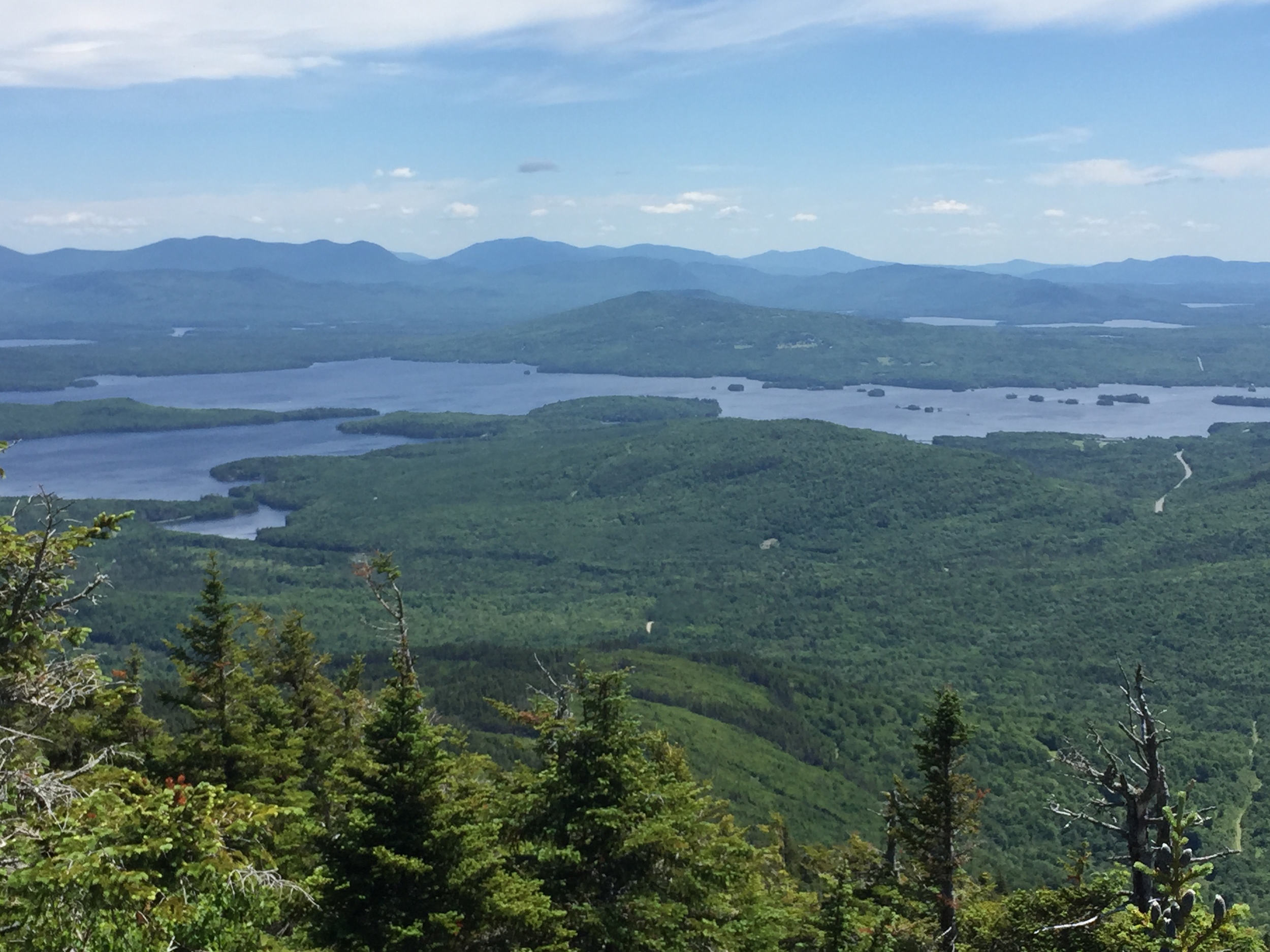
Finally, it was time for the half runners to fill in and take off.  The race immediately began by going up Poplar Street before turning and going uphill on the Golden Road.  The cold was nearly unbearable at first and it was four miles before I could finally feel my toes again!  When looking at the elevation profile of the race I wasn't super concerned about the hills, but it became very clear to me that the first six miles of the race were uphill the entire way!  About 4.5 miles in came our very first view of Katahdin and it was amazing to hear all the runners start to oooh and ahhhh!  Many stopped to grab photos while we kept running on.  About 6 miles in the race took a turn back toward the paved road and there was a great aid station with locals handing out water and gatorade, both of which were a slushy consistency.  I was happy to see the aid station because my hydration had frozen shut! (Turns out most people had this problem during the race). 

Action shot! 

Action shot! 

At about the halfway point of the race we finally left the logging roads behind and hit the paved portion of the race again.  Just before the turn off were tons of local folks out driving around and yelling support for the runners.  There were even a couple of cute kids with signs that read "I want to be like you when I grow up" and giving high fives!  I thought once we hit the pavement we'd see some more substantial downhill, but I was WRONG AGAIN!  You don't realize how hilly Millinocket is until you're running it!  After hitting the snowmobile club we FINALLY hit some substantial downhill for what felt like the very first time.  I know this wasn't true, but it sure felt it!  Running past Sawmill Bar and Grill the road flattened out back on route 11 for a few minutes.  We passed mile 12 at Katahdin General Store and then I saw the race was taking a turn.  While other people yelled out "oh a turn!" I was internally dreading it!  I knew that turning on Bates meant one thing - one more tiny hill.  From running and biking this hill nearly every day when I'm in town I knew this tiny hill would be a ball buster.  And it was.  So many groans were let out by everyone all around me.  When we reached the crest of the hill to take the final turn onto Penobscot Ave there were two women in down parkas handing out homemade cookies and cheering us all on.  

We run down to Penobscot Ave and we're finally in the home stretch.  I checked my watch and realized that the damn sub 2-hr half was once again just out of reach for me, but I pick up the pace to finish strong anyway.  Running down to the main intersection I see the Welcome Runner's sign just before really opening up my speed to run down the middle of the main street in town.  Design Lab had lots of music blaring and people were lining the streets cheering for us to finish.  We pick up speed triumphantly and run through the middle of the two loaded logging trucks signifying the finish. NoKey and I crossed the finish line at the exact same time for a finish time of 2:04:30.  Not a PR for me, but an automatic one for NoKey - this was his first ever half marathon!
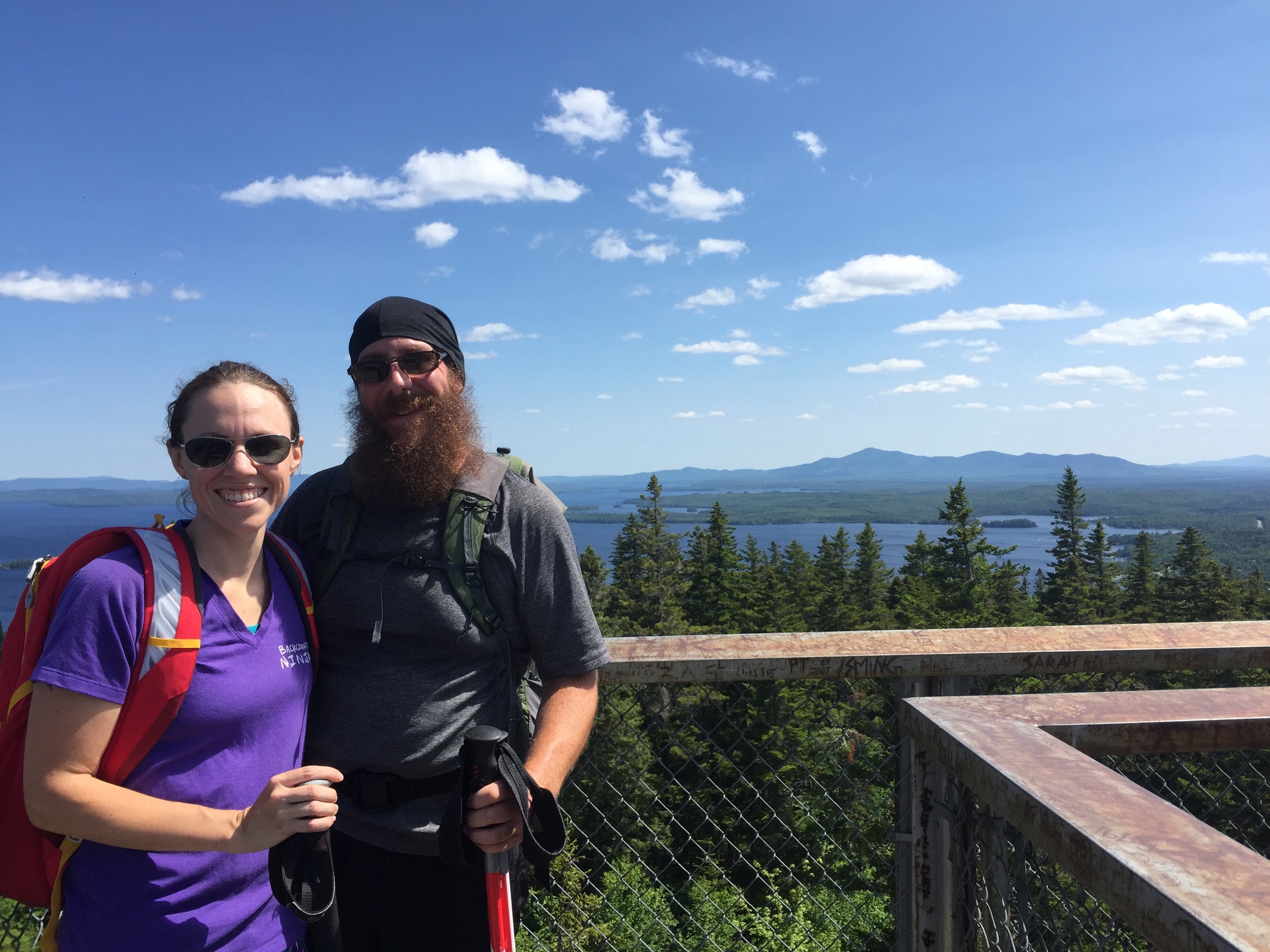
Post race selfie! 

Post race selfie! 

Upon finishing the race someone kindly threw an emergency blanket over both of us and we headed up to the Bangor Savings Bank tent and got a free bag of pretzels and a small gatorade.  We were also able to snag a few Stonyfield Organic yogurts as well.  It was such a nice gesture to see all the finish line swag - for a free race this one sure had a ton of perks!  We went back to the hotel to shower and stretch before heading back out into town to do some more Christmas shopping and get lunch.  We cheered on the runners who were still out on the course every time we saw one.  

Being able to spend time in the town we love and being able to give back  somehow made this race worth the long drive and cold trip.  We loved the energy from all the people in town.  It was so great seeing how supported the runners would be.  NoKey and I have even decided to make this our new Christmas tradition - a yearly trip up to Millinocket for Christmas shopping and race running!  

Me and my medal - handmade at the Moose Drop In. 

Me and my medal - handmade at the Moose Drop In. 

What's the furthest you've ever traveled to run or hike?  Would you do it again? Do you think we're insane for going to Maine in December to freeze at a race?

Opinion - In Defense of Baxter State Park

With all the controversy going on surrounding Baxter State Park recently I've really been trying hard to bite my tongue; however, yesterday I saw a hiker friend of mine liked a link a friend of theirs posted to Facebook regarding Scott Jurek taking Baxter State Park to court regarding his three summons issued during his record-breaking hike.  The caption written by the poster was "I hope this puts Baxter Park in their place."  My silence is now going to be broken. 

Baxter State Park isn't your typical state park.  In fact, even though it is considered a Maine State Park, it is an entirely separate entity from all the others.  Baxter State Park is a special place, receiving no tax dollars from Maine residents and is only open through the collection of user fees and the grant given by Governor Percival Baxter - the man who purchased all the individual tracts of land which now make up the park in hopes of preserving the wilderness of the Maine woods in an area where logging was king for much of the late 19th and nearly all of the 20th centuries.  The park is a true wilderness area and is not allowed to expand the roads or facilities - no running water or electricity are in this park at all and this will always be the way.  

The big controversy surrounding the Appalachian Trail began in the fall of 2014, when the park composed an open letter to the Appalachian Trail Conservancy regarding the swelling problems created by thru hikers, mostly the hikers ending their hikes at Katahdin, but also by the sheer numbers of people who are entirely unprepared to hike southbound from the park as well.  This letter can be seen by clicking the link above, but lists the many problems the park has had with thru hikers in recent years.  Contrary to popular belief, the park doesn't mainly cater to thru hikers and their families.  AT hikers only make up between 2-3% of the visitors in this park every year.    

The real issue of this letter came to a boiling point very recently, on Scott Jurek's record-breaking AT thru hike, in which he finished the trail in less than 47 days and beating Jennifer Pharr Davis' record from 2011 by three hours.  Jurek was issued three summons after his summit of Baxter Peak - one for littering, one for drinking alcohol on the summit, and another for hiking with a group larger than 12 people.  Jurek plans to fight the summons in court - and this is the reason for this opinion piece.  

I am 100% on the side of Baxter State Park on this issue.  Having worked very closely with the park during my time in Maine in 2013, I have seen the problems happening in the park and understand their anger regarding this record breaking hike.  This whole issue is not about having a celebratory drink on Katahdin and that seems to be the only thing hikers are complaining about.  This issue is about violating the rules.  If you don't know the rules, that is not a valid excuse for breaking them.  For example, on my 2012 thru hike I didn't know the rules about alcohol and I popped the champagne just like many other hikers before me.  This doesn't excuse my actions and if I were issued a summons, I would plead guilty and pay the fine, as breaking the rules is exactly what I did.  Saying "I'm a good person and I pack out my trash and I didn't know" doesn't make you not guilty of violating the guidelines you are to follow on the summit.  

The thing that is making the park officials the angriest, however, is the corporate sponsorship surrounding the event.  This point is completely glossed over by many in the hiking community.  Jurek wore a Clif Bar headband and had a support vehicle following him with the logo, as well as had a documentary crew following him.  While the company following his journey had obtained a permit to film in the park, they were told filming within 500 feet of the summit for commercial purposes was prohibited.  They chose to do so anyway.  Maine's largest wilderness area was home to corporate advertising on the day of Scott's summit, which isn't allowed.  

With the popularizing of the AT with this week's new film, A Walk in the Woods, Baxter Park has grown more concerned for the future of the impacts that will be made there.  The park has already written in their letter I linked to above that they can and will consider moving the trail completely out of the park, meaning hikers wishing to finish on Katahdin will have to follow the same procedures as everyone else who wishes to climb the mountain.  While I would be saddened to see the trail move, it by no means indicates you can't hike Maine's tallest peak - it only means what most AT hikers seem to forget: You are not special or entitled just because you walked here.  In order for the wilderness of Baxter State Park to be preserved, you might just have to sign up for your Katahdin permit online or register with the park in the future.  I don't see how this would be a bad thing.  

I would love to hear your opinions as to why or why not you agree with Baxter State Park on their stance of this issue.  Please leave me a comment or comment on this post on Facebook! If you would like to read more about the park's creation or learn the history of this very special place, visit their website here

Summary of the Detour - what we did on our "vacation"

When we got off the Finger Lakes Trail back in late June we had no idea we would essentially be off trail for an entire month.  It took me more than two weeks to shake the "cold" I developed in Marathon, NY and let me tell you it was a miserable two weeks.  We had been sitting around at home in Central New York, watching it rain every single day, meanwhile I was continuing to fester in my illness.  We had decided enough was enough and started planning a road trip, which I mentioned in a previous blog.  Here is what we did on that trip: 

Narraganset, Rhode Island - 
Since neither of us had ever been to Rhode Island, we decided to drive east.  We picked the first random town that came up when you searched Rhode Island on Google and that town was Narraganset.  When we got to Connecticut is when the sun finally came out for the first time in what felt like weeks.  We made it to the coast in time to eat dinner and watch the moon rise up over the Atlantic Ocean.  We found a state park nearby, Burlingame State Park, and went to set up our tent for the night.  We camped in a vicious thunderstorm here early the next morning - the worst and hardest rain I've ever camped in - and took a trip to Walmart to go grocery shopping.  We renewed our campsite for a second night and spent the day biking near the beach and then on a mountain bike loop at our campground.  We also had a chance to hike on the North-South Trail, a 70-mile trail that runs the length of the state with a high point of a staggering 824 feet!  The next day, however, the campground was going to be pretty full with the site we liked already being reserved and we decided it was time to move on. 

Lily Bay State Park - Greenville, Maine
We decided to head north from Rhode Island since more rain was headed to the east coast and seemed to all be south of Maine.  I was still pretty sick and coughing, but we decided I did sound much better from getting out of the rain.  We picked Lily Bay State Park from a Google search of state parks in Maine with showers.  They had a site for two nights leading into July 4th weekend, so we headed up to camp until July 4th.  In Greenville we spent some time hiking again.  We hiked Big Moose Mountain and Mount Kineo.  The most fun part of all this was that Mount Kineo is only accessible by boat!  We finally got some hiking in and I was a bit slower than usual, but we were able to do it.  Since we couldn't stay the night in the campground July 4th, we decided to head north yet again to our old home - Millinocket.  

Millinocket, Maine - 
When we got to Millinocket it was in the middle of the Independence Day Parade.  It turns out our friend Slim Pilgrim was also in town with a friend from college, so we were able to meet up with him.  We set up a home base at Wilderness Edge Campground just outside of town and ended up staying an entire week.  While we were in Millinocket we did a full slate of outdoor activities - hiking in the 100-mile Wilderness, hiking at Baxter State Park, kayaking on Ambejejus Lake, riding our bikes all over the place, and visiting a Moosehorn Wilderness Preserve in Calais, Maine.  Calais is also the end point of the 2900-mile East Coast Greenway system.  This system runs all the way to Key West, Florida!  After spending a week in Maine, we decided to come home for a few days and head on to our next destination. 

Ohio/Kentucky - 
After a few days at home, we headed south yet again to visit a friend of ours in Kentucky.  We had some business to take care of in Tennessee and Virginia, so we were trying to get down there before the time expired for us to do that.  We camped in a Walmart parking lot near Kings Island in Ohio before heading down to visit our friend Flash in Kentucky.  We spent the entire day with him and had planned on heading to Mammoth Cave National Park, but time didn't really permit that to happen.  We instead headed down to my parents' house in East Tennessee. 

Tennessee/Smoky Mountains - 
We got to Tennessee one day before we had to get to Virginia, so it worked out perfectly.  While we were in East Tennessee we spent a lot of time in the Smokies, hiking Ramsey Cascades, Mt. LeConte, the Gatlinburg Trail (with our dog!), and a waterfall in Tremont.  We also got to bike the loop road in Cades Cove and go tubing on the Little Pigeon River.  We got to spend time with our dog for a while too, which was really nice because we miss her a LOT!  I also finally had a chance to go to a walk-in clinic where we discovered I had gotten sick in the first place from a MRSA infection and that is why the leg rash I had wouldn't go away.  I got some powerful antibiotics and disinfectant for my skin.  We had planned on biking the Creeper Trail and driving the Blue Ridge Parkway, but the heat and humidity making the "real feel" temperatures well over 100 degrees every day didn't exactly make us want to drive slow in the sun and look at views, so we headed home. 

Now we are getting ready to leave for the Long Trail.  I've mailed our resupplies, planned out our first town stop, packed the backpacks, and even some additional supplies for after the hike.  We will be doing a traditional style thru hike on this trail, so we won't be coming home until the end.  Blog posts for this hike will begin very soon!  I can't wait to share our trip with you guys.  If you want to see more "real time" photos of our trip, please follow either of us on Instagram @SprinklesHikes or @NoKeyRules.  Happy Trails!

Throwback Thursday #6 - Gulf Hagas loop hiking in July 2013. 

The Gulf Hagas rim trails are known only in passing to AT thru hikers.  By reading guidebooks, you’ll know that 0.7 miles apart, the AT bisects the Gulf Hagas Trail, but it takes you more than 5 miles to hike that distance if you take the Gulf Hagas Trail.  Many thru hikers keep on going when they have this gem of a hike within a stone’s throw of Katahdin.  

This trail system has some beautiful waterfalls, seven to be exact, and is extremely rugged hiking.  When we hiked it in July it was incredibly hot and the black flies were brutal, but being that we had to cross the east branch of the Pleasant River to get there, it was nice to get the chance to cool off a few times during the hike.  Despite being a waterfall-heavy trail, there are only two stream crossings that are of any concern.  The only hitch in our day was the fact that one of the trail signs wasn’t properly secured in the ground and had actually been turned, so we did “bonus miles” taking us to the Head of the Gulf instead of back to the AT.  Thankfully, we ran into the only people we would see all day on this particular trail and they showed us their map, getting us back on course.  

The photos you’re seeing above are: 1) The plaque on the other side of the second water crossing with the double blue blazes, letting you know you’re now off the AT and in Gulf Hagas, which is designated as a National Scenic Landmark; 2) Screw Auger Falls; 3) Buttermilk Falls; 4) A typical canyon/gorge that follows this trail system. The water below feeds the east branch of the Pleasant River; 5) The Head of the Gulf, where two large streams convene into a larger one and create the system which feeds the waterfalls. 

Throwback Thursday #5 - Hiking southbound on the AT over Chairback and down Third Mountain Trail, forming a loop with the logging roads in the 100 Mile Wilderness.  

We did this hike in June 2013.  The Gulf Hagas area of the 100 Mile Wilderness takes nearly 2 hours to drive to from Millinocket, but the drive is definitely worth it.  We decided to hike a “loop” that we formed by hiking southbound up and over Chairback, down Third Mountain, Trail, and finally hiking 2 miles on the logging roads back to our car at the Gulf Hagas Trailhead.  The weather was beautiful and starting to warm up, but the warm weather and sunshine after weeks of rain and cold in Central Maine means one thing - BLACK FLIES.  They were absolutely brutal on this hike, nailing us in the face and back of the neck (they left scabs on my neck for weeks after this hike!) 

The hiking southbound over this mountain, which is a boulder-scramble for the SoBo’s, was a lot tougher than it seemed the first time we hiked it (northbound, of course) during our thru hike in early September 2012. A 16-mile day in the 100 Mile Wilderness was ambitious and it was a full day of hiking, but the views were stunning and the hike left us both blissfully exhausted.  Above, you’ll see 1) the view from Monument Cliff, 2) a bog on the logging roads on the way back to the car, 3) the typical trail scenery in this part of Maine, 4) the view looking at the back of Chairback (aptly named, now you can see), and 5) NoKey on top of Chairback. 

The Beauty of Acadia National Park - Throwback Thursday blog #2

In early September, NoKey and I took our day off to visit Acadia National Park.  We had wanted to go since arriving in Maine, but we also wanted to miss the tourists in Bar Harbor.  September brought cooler and damper weather, but smaller crowds!  Since it was raining that morning, we had a limited opportunity to get any hiking in, which is okay in Acadia since you can drive to the top of Cadillac Mountain.  We decided to call it “car hiking” and enjoyed it very much (other than the fact that there were bus loads of elderly people milling about up top!)  Since it was raining and misting, we didn’t expect many views, but it was still stunning to be on top of a mountain and be above treeline at only 1500 feet.  The mist and cooler weather definitely made you feel the fall-like atmosphere, and the smell of the coniferous trees took us back to the days we hiked in the soaking rains of New Hampshire for two weeks back during our thru hike.  

We walked on the large paved paths and then found the roads less-traveled on some muddier ones.  We even did something true to a Sprinkles and NoKey hike and went exploring on unmarked trails.  After we’d had enough of the crowds, we did more “car hiking” around the park and drove along the coast of Maine, seeing beautiful bays and Thunder Hole.  We enjoyed the sites in Acadia and would one day like to go back for some hiking and possibly bike riding along the loop.  There is no backpacking allowed in the park due to the fragility of the alpine plantlife and the harsh conditions of Mt. Desert Island.  

This was also the day before NoKey’s birthday, so we took time out to go out and grab a bite to eat in a good restaurant and a good quality draft beer, something we didn’t get much of in Millinocket!

There wasn’t a whole lot of hiking done, but every once in a while it’s about relaxation… and we really enjoyed our trip out to the Maine coast. The photos are (1) The view from Cadillac Mountain into Frenchman Bay. (2) A beautiful, classically rocky view of the Atlantic from the Maine coast. (3) A serene and sandy beach on the southern part of the island.  

Today NoKey and I went hiking in Baxter State Park after more than a week of rain and being stuck indoors.  This was our first official hike together since we finished the AT more than 7 months ago.  We hiked north from the AT from the Abol Bridge a…

Today NoKey and I went hiking in Baxter State Park after more than a week of rain and being stuck indoors.  This was our first official hike together since we finished the AT more than 7 months ago.  We hiked north from the AT from the Abol Bridge after taking in the morning view.  There was a ton of snow as it had snowed up there Friday and Saturday nights.  We were able to keep dry feet for about 4.5 miles when we ran into a SoBo, our first official trail SoBo, who let us know that Neswadonahunk Stream was running high and we’d definitely have to take the high water trail.  Even this trail had high water!  We got our feet pretty wet before coming back to the AT and passing both Big and Little Niagra Falls.  We walked around Daicey Pond and were less than a mile from Katahdin Stream Campground when we thought we heard someone in the woods.  We kept going, but heard a voice behind us… it was Erick, a hiker who stayed with us for a few days waiting for the high water to receed before starting his section hike.  He made the statement “Only you two could make a SoBo hike north on the AT to catch you!”  We gave him half of a giant sub and some Little Debbie cakes for trail magic before we ran into another one of our hikers from the weekend, Stinky Jesus! (We named him SJ because a hiker came in hypothermic and he helped him take off his boots to help him into the shower.)  We gave SJ some trail magic too and wished him well for his hike.  

After getting to Katahdin Stream we decided to take a break, but the black flies and mosquitos were out in full force, so we kept moving on to the Blueberry Ledges Trail.  We had no idea what to expect on this trail, as we’d not ever really seen pictures.  Much of the trail was flooded for the first two miles and had been washed out quite a bit from all the rain last week, but we kept on until coming to the ledges, which were all granite rock with alpine plants.  The ledges go downhill to meet Katahdin Stream, which was running swift and high.  (Pictured above).  From here, we had a short 1.4-mile walk back to the AT near Abol Bridge and it couldn’t have been more pleasant, an old roadbed where we followed moose prints nearly the entire way down.  At the bottom of the trail we had another wonderful view of Katahdin and much of the snow melted in the direct sunlight and 70+ degree temperatures of the afternoon.  

It felt great to be hiking again back into Maine.  I can’t wait to get back into the 100 Mile Wilderness next time!

"Sometimes you will never know the value of a moment until it becomes a memory." - Dr. Suess
This was me one year ago today, 11:00 a.m. at Springer Mountain in Georgia.  I had walked the 0.9 miles up to this plaque from the parking lot on the forest…

"Sometimes you will never know the value of a moment until it becomes a memory." - Dr. Suess

This was me one year ago today, 11:00 a.m. at Springer Mountain in Georgia.  I had walked the 0.9 miles up to this plaque from the parking lot on the forest service road in about 15 minutes.  My head and my stomach were filled with butterflies as I took those steps, saying only “excuse me, excuse me” as I was passing the crowds of people going up to the southern terminus of the Appalachian Trail.  When I finally got there, I took a look at the view, got my photo taken (above) with the first white blaze of the AT, and then wrote a rambling, nonsensical, excited first journal entry in the log book.  This is it, 5 million steps until I quit.  

It was such a beautiful, warm, sunny day on March 27, 2012. My plan for the day was to walk until I felt like I didn’t want to do it anymore.  Even so early in the day, I was passing people setting up their tents for the day on the side of the trail and meeting lots of hikers.  The thing that really stuck out in my mind was how excited we all seemed, greeting everyone walking by with a smile and awkwardly listening to people trying to decide if they had a trail name or if they should use their real names.  I immediately began with using my trail name, feeling like it was a totally different persona.  People almost looked relieved when you gave them a trail name, as if to say “well, you’re doing it, so I can too!”  But enough with my first day memories!

I had no idea how much this day would completely change my entire life. You hike the AT and you know something is going to change. In fact, Warren Doyle (a 17-time thru hiker who holds seminars a few times a year) has been known to tell everyone he meets who intends to hike that if you don’t want your life to change you shouldn’t go.  I feel like one year ago today isn’t an anniversary of a journey beginning, I feel like it’s more of a birthday.  I discovered so many things about myself on this trip, even if it wasn’t apparent to me at the time.  I made life-long friends with people who I only knew for only a few days, which is mind-blowing to me.  We all supported each other and, in a way, became a family in a short period of time.  For all of those who were with me on the AT in 2012, be it as a thru hiker, a section hiker, or a trail angel, you helped me become the person I am today and sharing that portion of my life with you means a lot to me. 

In less than one month, I’ll be leaving my home in Knoxville behind to continue on my journey.  I’ll be moving to Millinocket, Maine to work at the Appalachian Trail Lodge for the hiking season.  If the job works out for the summer, it’s possible I’ll stay on year-round.  One year ago today I would’ve never guessed this would be my life.  I’m excited for all the changes and I can’t wait to share all my new travels and experiences with you.