ME

Throwback Thursday #6 - Gulf Hagas loop hiking in July 2013. 

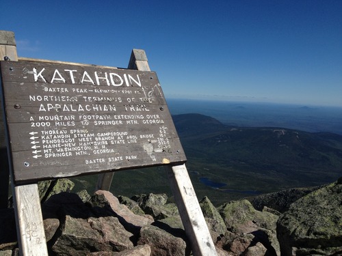
The Gulf Hagas rim trails are known only in passing to AT thru hikers.  By reading guidebooks, you’ll know that 0.7 miles apart, the AT bisects the Gulf Hagas Trail, but it takes you more than 5 miles to hike that distance if you take the Gulf Hagas Trail.  Many thru hikers keep on going when they have this gem of a hike within a stone’s throw of Katahdin.  

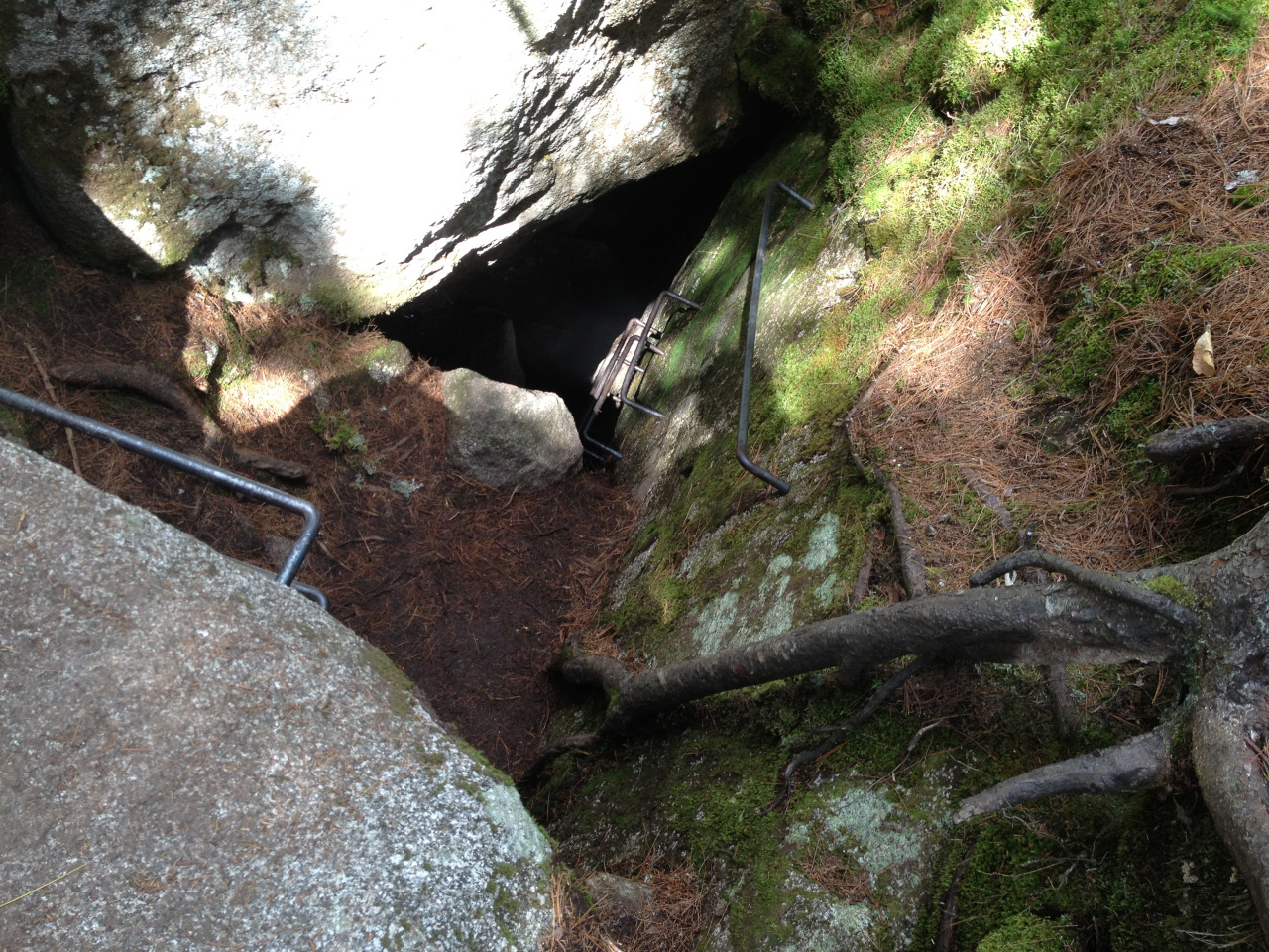
This trail system has some beautiful waterfalls, seven to be exact, and is extremely rugged hiking.  When we hiked it in July it was incredibly hot and the black flies were brutal, but being that we had to cross the east branch of the Pleasant River to get there, it was nice to get the chance to cool off a few times during the hike.  Despite being a waterfall-heavy trail, there are only two stream crossings that are of any concern.  The only hitch in our day was the fact that one of the trail signs wasn’t properly secured in the ground and had actually been turned, so we did “bonus miles” taking us to the Head of the Gulf instead of back to the AT.  Thankfully, we ran into the only people we would see all day on this particular trail and they showed us their map, getting us back on course.  

The photos you’re seeing above are: 1) The plaque on the other side of the second water crossing with the double blue blazes, letting you know you’re now off the AT and in Gulf Hagas, which is designated as a National Scenic Landmark; 2) Screw Auger Falls; 3) Buttermilk Falls; 4) A typical canyon/gorge that follows this trail system. The water below feeds the east branch of the Pleasant River; 5) The Head of the Gulf, where two large streams convene into a larger one and create the system which feeds the waterfalls. 

Throwback Thursday #5 - Hiking southbound on the AT over Chairback and down Third Mountain Trail, forming a loop with the logging roads in the 100 Mile Wilderness.  

We did this hike in June 2013.  The Gulf Hagas area of the 100 Mile Wilderness takes nearly 2 hours to drive to from Millinocket, but the drive is definitely worth it.  We decided to hike a “loop” that we formed by hiking southbound up and over Chairback, down Third Mountain, Trail, and finally hiking 2 miles on the logging roads back to our car at the Gulf Hagas Trailhead.  The weather was beautiful and starting to warm up, but the warm weather and sunshine after weeks of rain and cold in Central Maine means one thing - BLACK FLIES.  They were absolutely brutal on this hike, nailing us in the face and back of the neck (they left scabs on my neck for weeks after this hike!) 

The hiking southbound over this mountain, which is a boulder-scramble for the SoBo’s, was a lot tougher than it seemed the first time we hiked it (northbound, of course) during our thru hike in early September 2012. A 16-mile day in the 100 Mile Wilderness was ambitious and it was a full day of hiking, but the views were stunning and the hike left us both blissfully exhausted.  Above, you’ll see 1) the view from Monument Cliff, 2) a bog on the logging roads on the way back to the car, 3) the typical trail scenery in this part of Maine, 4) the view looking at the back of Chairback (aptly named, now you can see), and 5) NoKey on top of Chairback. 

Throwback Thursday #4 - Ice Caves Trail and canoeing on Grand Lake Matagammon.

In early August the warm and clear weather provided me a chance to go to see the Ice Caves, a trail that isn’t long but has frozen caves with ice nearly all year long.  I’d heard about this trail from some of the hiker’s families and had been wanting to go, so I was excited to finally get the opportunity.  NoKey wasn’t feeling well this morning, so I set out to see the caves myself.  The drive from Millinocket isn’t bad at all. Taking 11 North to the Golden Road and driving out to Abol Bridge, across the bridge, and then taking the first left after the bridge will get you out to the road on which the Ice Caves Trail is located.  The trailhead is about 2 miles down this 1.5-lane gravel road, which also has some beautiful campsites maintained by the Maine State Parks, some of which have a stunning view of Katahdin.  I was surprised, and a bit happy, to see I was the only car in the parking lot this morning.  Last time I drove out here to find the trailhead, there was not a single place to park, let alone turn my car around!

I started the hike by crossing a former logging bridge and then turning left to follow the blue blazed trail.  This is an easy 1.2 miles to the Ice Caves without much elevation gain at all.  Immediately you get the serene feeling you can only find in the Maine woods.  The smell of pine needles with the softness of the pine bed underfoot is immediately calming and makes for great hiking, not to mention the quiet of the 100 Mile Wilderness located just across the lake!  After walking 0.9 miles, there is a trail junction where you can go go up to an overlook, down to the Ice Caves, or even further down to First Debsconeag Lake.  First, I went up to the overlook which stands over the lake and looks at Rainbow Mountain.  I could see a canoe slowly making its way across the lake and sat on a rock to soak up some sunshine.  After a short break, I decided to venture down to the Ice Caves, which were not at all what I expected! I saw the sign marking the caves and a small hole in the ground with an iron bar to guide me down… I didn’t think I’d fit!  Thankfully, I was able to get down into the caves without any problems but was disappointed to see there was only a thin layer of ice left, which is understandable for August.  The cave had a layer of thick mist hanging in the air and was a nice cool sanctuary for the humid August morning.  After looking around for a bit and getting creeped out at being alone, I climbed back out of the cave and headed down the 0.2 miles to First Debsconeag Lake.  This part of the trail was fairly newly dug with lots of switchbacks and some nice step work leading down to the lake. The trail ended directly in the lake I had looked at half an hour earlier from the overlook.  

When I arrived home, NoKey was feeling better and ready to get out of the house so we decided to make the long drive up to the north end of Baxter State Park since we’d heard they rent canoes for the bargain price of $1 per hour!  It’s nearly 2 hours of drive time to the north end from Millinocket, taking I-95 north to exit 264, turning left, and following the signs through Sherman, Patten, and Shin Pond.  When we arrived at the Matagammon Gate, we encountered Dana, a friendly ranger who had been with the park since the 1950s.  He was a great conversationalist and was probably a bit lonely working this end of the park, since hardly anyone is ever up here!  He let us in without charging us the out-of-state fee ($14 per car) and threw us a canoe key.  It was about 2:00 p.m. when we got out onto the lake and while there was some sunshine to the east of us, to the west we could tell a storm was blowing in.  We canoed around the lake for a little over an hour before the choppiness of the water let us know the storm was close enough and we got out of the park.  We headed to Craig’s Clam Shop for the first time and thus began our love affair with them!

The photos above: 1) The trail junction on the Ice Caves Trail; 2) Looking down into the ice caves; 3) A view of Katahdin over the Penobscot River; 4) Our canoe stealthily locked away in the woods; 5) Katahdin from the north side with the rain clouds looming. 

Canoeing South Branch Pond and hiking North Traveler Mountain, Throwback Thursday #3

In late August, we were seeking solitude from the massive number of people we had seen in the previous weeks due to Northbounder season being in full swing.  The north end of Baxter State Park provided the perfect escape and dose of nature we needed to maintain our sanity! We drove the 2 hours north and around through rural northern Maine to the Matagamon Gate of the park, and then another 45 minutes or so on the winding and narrow Tote Road to South Branch Pond.  In the park, for a bargain price of $1 per hour you can rent a canoe.  We did just that and canoed around South Branch Pond for two hours enjoying the sunshine and a cool breeze.  The pond has a small outlet into a second smaller pond, where we beached our boat and walked the short path for a stunning view of the Knife Edge of Katahdin from the northern side, one many people, especially visitors to the area, don’t get to see.  After a few hours and some worn out arms, we turned in our canoeing gear, threw on our packs, and headed up North Traveler Mountain.  This is a challenging loop trail you can complete, but in August it’s recommended you start before 8 a.m.  Since it was late in the day, we only went to the peak and then back down.  The climb was actually tougher than I had expected, but most climbs in Maine usually are!  We were treated to a stunning view of South Branch and Black Cat Mountains, as well as the Knife Edge in the far background.  Looking north, the land is farms and small hills mostly, but incredibly unspoiled.  We had found our solitude!

After coming back down the mountain and getting back to the car we had decided we weren’t quite yet done for the day.  Consulting the map showed us that South Branch Falls would be a short 1.5 mile addition to our day, so off we went for that hike.  We hiked mostly level and a little downhill to the falls, which weren’t quite full, but still beautiful nonetheless.  We did some bouldering and soaked up some sun on the warm rocks before calling it a day.  When we returned to the small parking area, we met some people who had noticed our AT sticker on the car and asked us about our thru hike.  They lived south of us, near Pleasant Pond Mountain (just outside Caratunk, ME) and did some maintaining for the MATC.  The trail truly can connect us anywhere, even when we’re not on it!

After leaving, we drove the Tote Road a little further south before turning around and calling it a day.  The best part of going to the north end of the park may be the beauty and solitude, but the second best is the food!  Craig’s Clam Shop (affectionately known to us as “The Clam Slam”) is in Patten, Maine, and the food there is outta this world!  We stop in for milkshakes, burgers, and handcut fries made from potatoes in the fields less than a mile away.  It’s always a great end to a day in northern Maine!

The photos today are from the beach of South Branch Pond before pushing off in our canoe, looking at the Traveler Mountain range, a sign warning you that rescue can be hours away (and they aren’t kidding, this place is REMOTE!), and the view from North Traveler looking at Black Cat Mountain with Knife Edge on the far right side. 

Today NoKey and I went hiking in Baxter State Park after more than a week of rain and being stuck indoors.  This was our first official hike together since we finished the AT more than 7 months ago.  We hiked north from the AT from the Abol Bridge a…

Today NoKey and I went hiking in Baxter State Park after more than a week of rain and being stuck indoors.  This was our first official hike together since we finished the AT more than 7 months ago.  We hiked north from the AT from the Abol Bridge after taking in the morning view.  There was a ton of snow as it had snowed up there Friday and Saturday nights.  We were able to keep dry feet for about 4.5 miles when we ran into a SoBo, our first official trail SoBo, who let us know that Neswadonahunk Stream was running high and we’d definitely have to take the high water trail.  Even this trail had high water!  We got our feet pretty wet before coming back to the AT and passing both Big and Little Niagra Falls.  We walked around Daicey Pond and were less than a mile from Katahdin Stream Campground when we thought we heard someone in the woods.  We kept going, but heard a voice behind us… it was Erick, a hiker who stayed with us for a few days waiting for the high water to receed before starting his section hike.  He made the statement “Only you two could make a SoBo hike north on the AT to catch you!”  We gave him half of a giant sub and some Little Debbie cakes for trail magic before we ran into another one of our hikers from the weekend, Stinky Jesus! (We named him SJ because a hiker came in hypothermic and he helped him take off his boots to help him into the shower.)  We gave SJ some trail magic too and wished him well for his hike.  

After getting to Katahdin Stream we decided to take a break, but the black flies and mosquitos were out in full force, so we kept moving on to the Blueberry Ledges Trail.  We had no idea what to expect on this trail, as we’d not ever really seen pictures.  Much of the trail was flooded for the first two miles and had been washed out quite a bit from all the rain last week, but we kept on until coming to the ledges, which were all granite rock with alpine plants.  The ledges go downhill to meet Katahdin Stream, which was running swift and high.  (Pictured above).  From here, we had a short 1.4-mile walk back to the AT near Abol Bridge and it couldn’t have been more pleasant, an old roadbed where we followed moose prints nearly the entire way down.  At the bottom of the trail we had another wonderful view of Katahdin and much of the snow melted in the direct sunlight and 70+ degree temperatures of the afternoon.  

It felt great to be hiking again back into Maine.  I can’t wait to get back into the 100 Mile Wilderness next time!

"Sometimes you will never know the value of a moment until it becomes a memory." - Dr. Suess
This was me one year ago today, 11:00 a.m. at Springer Mountain in Georgia.  I had walked the 0.9 miles up to this plaque from the parking lot on the forest…

"Sometimes you will never know the value of a moment until it becomes a memory." - Dr. Suess

This was me one year ago today, 11:00 a.m. at Springer Mountain in Georgia.  I had walked the 0.9 miles up to this plaque from the parking lot on the forest service road in about 15 minutes.  My head and my stomach were filled with butterflies as I took those steps, saying only “excuse me, excuse me” as I was passing the crowds of people going up to the southern terminus of the Appalachian Trail.  When I finally got there, I took a look at the view, got my photo taken (above) with the first white blaze of the AT, and then wrote a rambling, nonsensical, excited first journal entry in the log book.  This is it, 5 million steps until I quit.  

It was such a beautiful, warm, sunny day on March 27, 2012. My plan for the day was to walk until I felt like I didn’t want to do it anymore.  Even so early in the day, I was passing people setting up their tents for the day on the side of the trail and meeting lots of hikers.  The thing that really stuck out in my mind was how excited we all seemed, greeting everyone walking by with a smile and awkwardly listening to people trying to decide if they had a trail name or if they should use their real names.  I immediately began with using my trail name, feeling like it was a totally different persona.  People almost looked relieved when you gave them a trail name, as if to say “well, you’re doing it, so I can too!”  But enough with my first day memories!

I had no idea how much this day would completely change my entire life. You hike the AT and you know something is going to change. In fact, Warren Doyle (a 17-time thru hiker who holds seminars a few times a year) has been known to tell everyone he meets who intends to hike that if you don’t want your life to change you shouldn’t go.  I feel like one year ago today isn’t an anniversary of a journey beginning, I feel like it’s more of a birthday.  I discovered so many things about myself on this trip, even if it wasn’t apparent to me at the time.  I made life-long friends with people who I only knew for only a few days, which is mind-blowing to me.  We all supported each other and, in a way, became a family in a short period of time.  For all of those who were with me on the AT in 2012, be it as a thru hiker, a section hiker, or a trail angel, you helped me become the person I am today and sharing that portion of my life with you means a lot to me. 

In less than one month, I’ll be leaving my home in Knoxville behind to continue on my journey.  I’ll be moving to Millinocket, Maine to work at the Appalachian Trail Lodge for the hiking season.  If the job works out for the summer, it’s possible I’ll stay on year-round.  One year ago today I would’ve never guessed this would be my life.  I’m excited for all the changes and I can’t wait to share all my new travels and experiences with you.  

The Final Day

I’ve officially been finished with the Appalachian Trail for one week and it seems like the entire experience is another world away.  I’ll be writing a series of blogs over the next few weeks about my adjusting back to home life again, as well as some reflections on the trail and how it impacted my life in both the good and bad ways.  

I suppose first I should talk about the emotional last day on the trail.  Nokey and I wanted to get up as early as possible to get up and down Katahdin in a reasonable amount of time as our plan was to do the Knife’s Edge Trail down.  We wanted to make sure David could pick us up in a reasonable amount of time to get us out to Abol Bridge Campground for showers, as well as for us to have enough time for dinner and to get the car packed.  We woke up at 6 a.m. and hoped to get started by 7:15.  In true Nokey and Sprinkles fashion, we of course didn’t start until half an hour after that!  We started up the Hunt Trail (AT) at 7:40 a.m. on Tuesday, 9-11-12, with David hiking with us for the first mile.  David left us at Katahdin Streams Falls about 1.25 miles up.  From here, the climb got a little more steep for a mile before turning into a shear granite climb.  We climbed up with the assistance of rebar in two places.  Nokey had to stop and turn around to give me a helping hand several times as I just wasn’t tall enough to reach the hand grips.  At 10:15 a.m., we reached an area of the mountain called The Tableland.  This area had a nice gentle slope up to the peak, which by now we could actually see the outline of the sign up top and people gathering.  We had a 45-minute hike from here to the peak.  When we got close and the sign came into view from the final ascent the emotion I felt was completely overwhelming.  We both walked over and touched the sign at 11 a.m.  

There were a lot of people on the summit, including several other thru hikers, Comanche, B-1, Tree Hugger, Sonic… several others came up while we were there as well.  We took an array of funny and celebratory photos, shot videos, took in the scenery, and reflected on our journey.  After sitting up top until 12:15 p.m., we decided that the wind hadn’t died enough for us to feel comfortable with hiking Knife’s Edge Trail.  We still didn’t want to hike back down the way we’d come up, so we decided to hike the Saddle Trail to Chimney Pond, where the trailhead actually met up with the Helon Taylor Trail, which was the original place David was going to pick us up.  We said goodbye to Lighthouse, Catnap, and Santa’s Helper for the last time. 

We hiked down the back side of The Tableland and took in the beautiful scenery.  After a mile and a half, we began the rapid descent down a rock slide to Chimney Pond. We had views back up to the top the entire time and it was just a gorgeous trail.  When we reached the bottom at 4 p.m., we were elated to have just completed such an epic journey together.  We hugged and I got a little teared up, but mostly we were just exhausted.

We drove to Abol Bridge and David went into the camp store while Nokey and I slipped into the campground with our $0.50 so we could take a hot 6-minute shower.  We ran into Trog at the campground and he congratulated us on our summit.  That was it.  Our trip had officially ended.  I was now clean and dressed in cotton clothes.  I never had to put on that stinky purple shirt or those black spandex shorts that gave me pack rash ever again.  We drove down Golden Road and showed David the AT and the 100-mile wilderness.  We took in our last view of Katahdin before heading back to the lean-to we’d rented for the night and cooking a big dinner together.  We sat around the campfire and recounted the details of the day and cherished our last night in the woods together.  

Finally!  The view from Katahdin on 9-11-12.  This video shows you just how many people were on the summit with us.  A lot of people wanted to go up for 9-11 to make it a good day in history for themselves.  We went up for Nokey’s birthday so he could have a good birthday memory for the first time in 11 years.  It was a gorgeous Class I day!

Here we are canoeing across the Kennebec River in Maine. The canoe is the official blazed route of the trail as the river is dam-released, unpredictable, and has a strong current. Tom, our canoe guide, talks about the current while he and Nokey paddle us across the river.  My apologies if you’ve seen this video on my Facebook page already!

This was shot in Maine, outside of Stratton, in the Bigelow Mountain Range.  I say in the video it’s called West Avery Peak, but it’s actually West Bigelow Peak.  Avery Peak is the next one.  I’ve been over a lot of mountains, so give me a break!  This video was posted on Facebook a few weeks ago, so some of you may have already seen it.  Anyway, it stars Chucky the Fish and Nokey.  

Here we are! We summited Mt. Katahdin on 9-11-12 at 11:00 a.m. after waiting for six days.  The 11th is Nokey’s birthday and we wanted to wait for that day.  After taking about 45 zeros on the trail, we finished the trail in 5.5 months for me …

Here we are! We summited Mt. Katahdin on 9-11-12 at 11:00 a.m. after waiting for six days.  The 11th is Nokey’s birthday and we wanted to wait for that day.  After taking about 45 zeros on the trail, we finished the trail in 5.5 months for me and six months, 1 day for Nokey.  I’ve been working on getting my videos posted, but the formatting issues are giving me problems.  I’ll be doing some blogging and photo updates in the next several days.  

I wanted to thank everyone who supported me on my thru hike, friends, family, and co-workers alike.  It meant a lot to me to get into town and have emails, texts, and voicemails from so many of you consistently throughout my trip.  There were times on the trail when I wanted nothing more than to just quit and come home.  There were other times I’d be angry with myself for ever doubting my abilities.  I’ve grown and changed a lot as a person in the past few months and I’m already looking forward to my next adventure, wherever it may take me!

Sorry for the lack of updates guys! The cell signal in Maine is so spotty that it’s hard for me to post anything, even in towns! I have a ton of videos and photos to post, as well as some blogs that will be updated after I get home. Our plan at this point is to summit on 9-11, Nokey’s birthday. We are taking our time and enter the 100-mile wilderness this afternoon. Thanks to everyone for their support and I’ll see you all very soon!