Appalachian Trail

The 14 AT States - Common Perceptions and Misconceptions

Whenever people talk about states along the Appalachian Trail just the mentioning of the name will give you an image in your head.  For those of us who have travelled the trail in those states, however, our perception of those states can be quite different.  My topic today is kind of a fun one - the expectation versus reality of the states along the Appalachian Trail.  

The map image came from The Cat's Meow Village and is available for purchase!

The map image came from The Cat's Meow Village and is available for purchase!

Georgia

Expectation: Springer Mountain - the beginning or end of a long journey. 
Reality: Well, you do get Springer Mountain.  You also get the crowds of newbies and all the excited and nervous energy that comes along with that journey.  It's truly a magical (albeit crowded at times) place!

North Carolina

Expectation: Max Patch-like views, your first/last state line to cross
Reality: Big climbs (anyone remember crossing from Georgia into North Carolina?!), your first 5000 foot peak, gorgeous southern Appalachian balds, and two trail town stops you can walk right into - the NOC and Hot Springs!
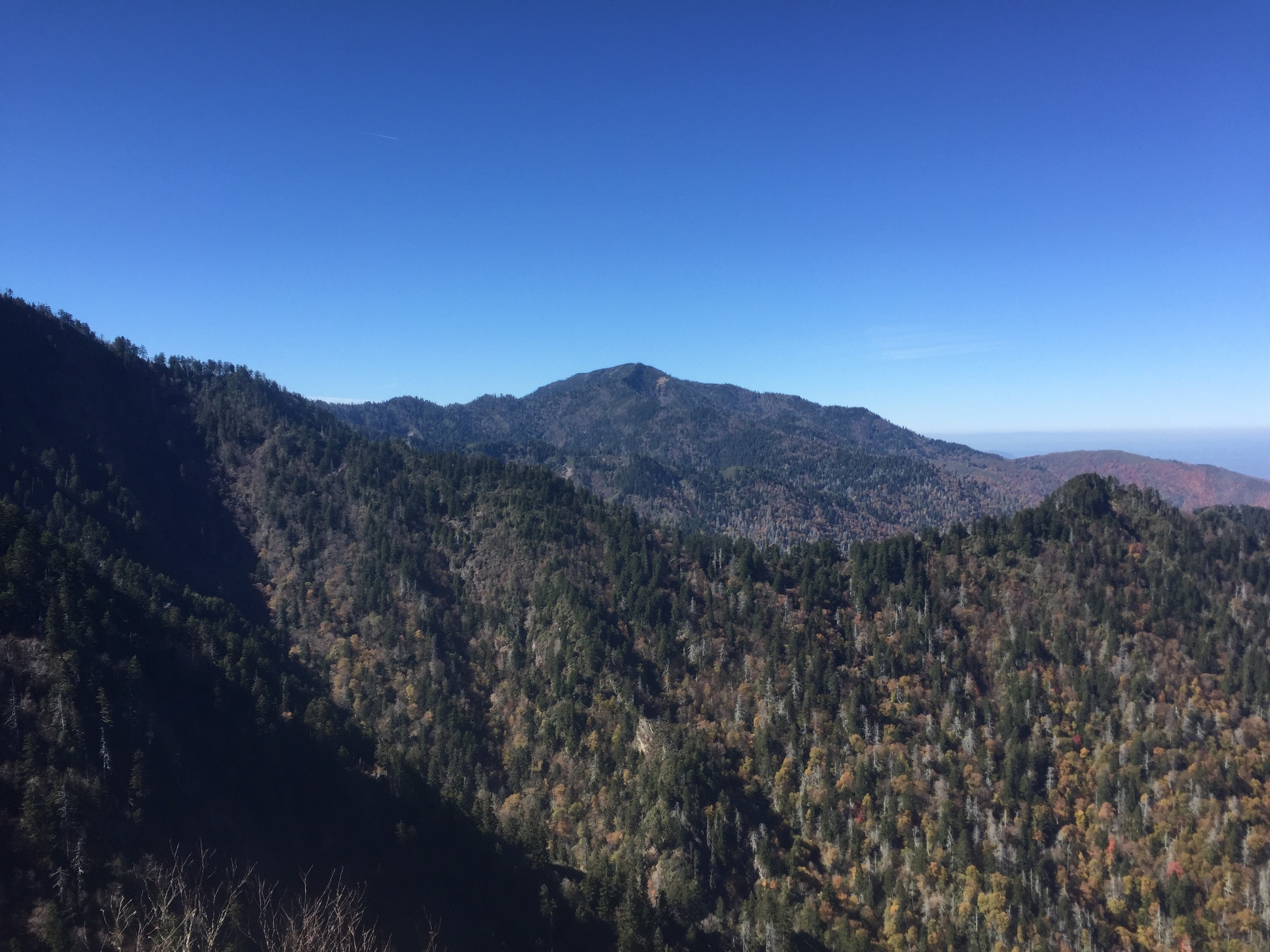
Tennessee

Expectation: The Smoky Mountains - this can mean snow or dreary weather to most hikers
Reality: You do get the Smokies, but we get good weather here too!  You also get the Roan Highlands, more gorgeous vistas, and views of the Nolichucky River from a cliff face further north near Erwin. 

Virginia

Expectation: "After Tennessee, Virginia is flat! You'll make easy 30-mile days there!"; the ponies and McAfee's Knob
Reality: Virginia isn't flat, and easy 30 mile days on the AT are hard to come by. Sure, you do get the ponies, and McAfee's Knob.  You also get Dragon's Tooth, Tinker Cliffs, and Shenandoah National Park.  You also get the Green Tunnel and the Virginia Blues.  The Blues are common for thru hikers (I even got them!) because of the Green Tunnel effect.  By the time most thru hikers reach VA spring has sprung and you're constantly in tunnels of rhododendron.  It can seem like endless miles in a persistent green state.  

West Virginia

Expectation: The halfway point at Harper's Ferry
Reality: While West Virginia is a short state with the fewest miles (many hikers do a 4-state challenge and skip through it in a matter of less than an hour), the actual halfway point of the Appalachian Trail is still quite a bit further north in Pennsylvania.  The Appalachian Trail Conservancy's Headquarters, however, is in Harper's Ferry and is a really cool place to stop by and kill a few hours!

Maryland

Expectation: A short and easy, relatively flat state without anything to see
Reality: It turns out Maryland is one of the prettiest states on the AT.  With lots of park/green space, relatively well-maintained trails, and really cool things to see, lots of hikers doing the Four State Challenge miss a really neat place.  Also in Maryland are Gathland State Park with a memorial dedicated to War Correspondence and the original Washington Monument.  You've also either just crossed or are about to cross the Mason-Dixon line into Pennsylvania. 

Pennsylvania

Expectation: Rocks. So.MANY.ROCKS.
Reality: Not so many rocks.  With approximately 230 miles of trail in Pennsylvania (lovingly nicknamed Rocksylvania), it seemed that every time we thought it was about to get rocky we would hear that it was actually not rocky yet.  We rolled into Caldonia State Park to hear that it actually doesn't get rocky until Duncannon.  Then when we got to Duncannon we were told it gets rocky at Port Clinton.  Then in Port Clinton we were told it doesn't get really rocky until Wind Gap.  By the time we hit Delaware Water Gap everyone had mixed emotions.  Many felt we never hit the rocks and others like we only hit rocks.  Little did the northbounders know what rocks would await us further north!

New Jersey

Expectation: Dirty water, smoggy and polluted air.
Reality:  It turns out New Jersey is actually a very pretty place to go on foot!  They don't call it the Garden State for nothing!  Walking through New York/New Jersey didn't take us over the highest peaks, but we did visit an ice cream stand, a beach at a state park, and walked through the Wallkill Game Preserve - a birding park that was absolutely gorgeous.  Lots of boardwalks and tall grasses awaited us here. 

New York

Expectation: Whenever you say New York, most people only think New York City. 
Reality: Well, you can actually see NYC from the trail!  From West Mountain Shelter and Bear Mountain you have gorgeous views are you're only about 30 miles away from it.  We also could hear cannon fire from nearby Westpoint.  You also can hike from deli to deli on this section of trail, as they're close to every trail crossing. A lot of thru hikers are surprised to find those promised rocks of PA in New York instead!  NoBo's and SoBo's alike complain of sore feet here!

Connecticut

Expectation: Snooty people who are rude to hikers. 
Reality: While the town of Kent, Connecticut has a reputation for being inhospitable we found that many people who went in didn't have a bad experience.  We stayed in a town called Falls Village and ate a very nice dinner at an incredibly upscale B&B and were treated very kindly.  We were also allowed to camp in the backyard of a quaint cafe here.  While the mosquitos were killer, the people were friendly!

Massachusetts 

Expectation: Massholes. 
Reality: Gorgeous hiking and history, phenomenal views into Vermont from Mount Greylock, and the Cookie Lady all make Massachusetts amazing.  Hiking through the Berkshires region in summertime is going to give you bogs and boardwalks and rocky summits.  You get a little bit of everything. 
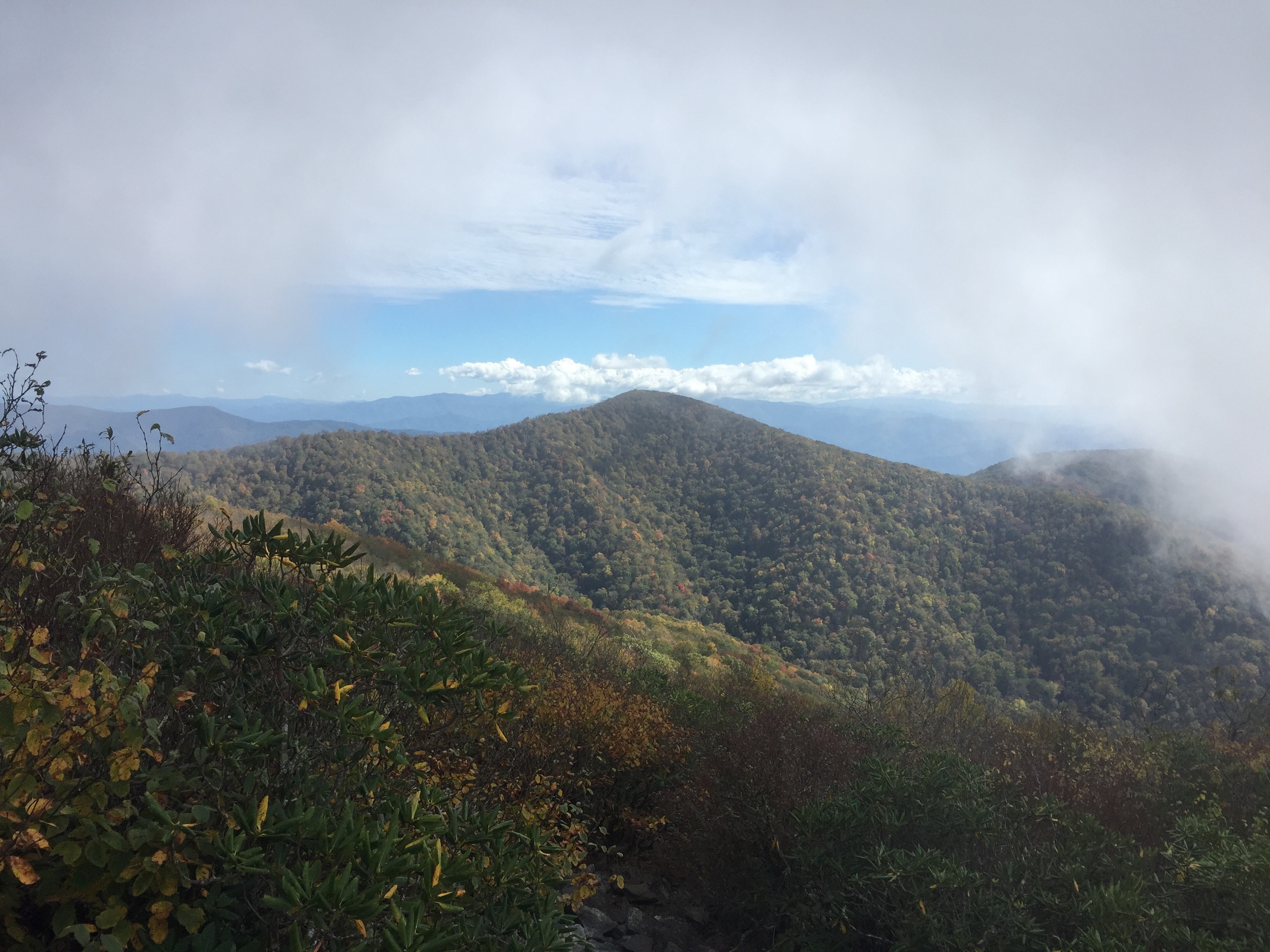
Vermont

Expectation: Mud
Reality: Okay, so there's a lot of mud.  But there's also some incredible trail maintenance!  When I hiked through in 2012 so much of southern Vermont was still reeling from the effects of Hurricane Irene.  When we hiked the Long Trail in 2015 it was very clear how much amazing work the Green Mountain Club had done to clean up the damage as well as drain a lot of the standing water on trail.  You also get gorgeous fire tower views in more remote places than you've seen further south, breathtaking boreal forest, and glacial ponds for swimming.  

New Hampshire

Expectation: Getting your butt kicked in the Whites and freezing cold temperatures even in summer.
Reality: The Whites do in fact have some of the worst weather in the world, especially on Mount Washington - the highest point in New England.  While we were here we didn't get many views, but The Whites were also known for making all the butt kicking worthwhile by rewarding you with alpine summits (meaning you're above tree line).  One thing I didn't expect in New Hampshire was the fact that despite being a strong hiker I would slow my pace to approximately a mile an hour - something that does happen to a lot of thru hikers!

Maine

Expectation: Katahdin and the epicness that is the 100-Mile Wilderness
Reality: You have 281 miles to hike in Maine before you finish the trail and first you are going to travel through some mountains even harder to hike than the Whites!  Southern Maine doesn't get nearly the attention the neighboring Whites do, but they're just as hard and exhausting.  The infamous Mahoosuc Notch is the hardest mile of trail (or most fun depending on what you're into!) on the entire AT!  Of course, you also get amazing views from those alpine summits, ponds so big they look like oceans, and then you get to cross the Kennebec River in a canoe.  You'll also find out that the big, bad, and scary 100-Mile Wilderness doesn't live up to it's hype and you'll make it through unscathed for your big finish at the summit of Katahdin.  

So, there you have it, the common ideas of what it's like to hike the fourteen states of the Appalachian Trail versus the reality of hiking them from someone who has.  Have you hiked through any of the states listed above?  What were your impressions of the Appalachian Trail there? I'd love to get your input in the comments below!

Reflections of the Appalachian Trail - Four Years Later

I recently had the opportunity to hit the Appalachian Trail from Springer Mountain in Georgia right in the middle of thru hiker season.  It was such a wonderful chance for me to relive some memories from my first few days on the AT with a woman who was setting out on her own to try tackling the trail.  From meeting newbies in the Springer Mountain parking area to seeing the Benton MacKaye Trail terminus to summiting Springer for the third time this trip was full of memories.  Here are some reflections I have from those few days down on the Georgia section of the Appalachian Trail. 

Since it was a long ride down to the southern terminus I had lots of time to think about all the feelings I had flowing through me.  No matter how many times I head to Springer over the course of my lifetime, I suspect that I'll always feel that nervous energy.  While I know I've successfully completed two trails with a terminus here, the feeling in your stomach is always the same - the excitement of getting out on trail and the uncertainty of knowing what each day will bring.  When we went to Amicalola Falls Lodge to pick up the friend I'd be hiking with I was just so excited to be seeing the Approach Trail.  While I've been to Springer twice before, I have never hiked the Approach Trail to the top.  There were quite a few newbie thru hikers (thrubies I've seen them called) and you could almost feel their excitement.  From the lodge we had about an hours' drive to the top of Springer going the back way the GPS device took us (which I would never recommend by the way - ALWAYS take Doublehead Gap Road!)

After climbing out of the car in the Springer Mountain parking lot the nervous butterflies mostly disappeared and I was mostly feeling excitement - excitement for both myself and my friend who would be experiencing the trail for the first time.  I made the 0.9 mile walk up to the southern terminus of the Appalachian Trail with her, talking to all the other thrubies hitting the trail for the first time.  To my surprise, I met several blog followers and Instagram followers up there!  For being a Tuesday in April there was a lot of activity happening up there at the summit.  Signing the registry book in the rock up there for the third time just made me feel like I was at home.  After walking the 0.9 miles back to the parking area I was reintroduced to Warren Doyle, whom I had met briefly when working at the AT Lodge in Millinocket back in 2013.  

Hey there, Springer Mountain! 

Hey there, Springer Mountain! 

The first day and evening on trail were a flurry of happy activity.  We did approximately 4 miles down to a campsite near a stream where I taught my friend how to throw a bear bag and we camped in relative cold temperatures.  The next day brought more hiking and quick thinking, using my finely tuned Yogi skills to get us a ride to cell phone service and a shuttle to Wolfpen Gap Country Store/Hostel in Suches, Georgia.  Riding through the Georgia countryside gave me a whole new view of the BMT and AT - it was very cool to see the mountains I have climbed so many times from a different perspective.  We stayed in the hostel and I got to see two old friends - Carry-On from my 2012 hike and Odie (of Hiker Yearbook fame) from my time working in the hostel in 2013 and going to The Gathering in 2014. I helped Carry-On do pack shakedowns at the amazing Top of Georgia Outfitters satellite store at Wolfpen Gap.  By the time our ride came to pick us up the next day I had felt like I already assimilated back into the Hikertrash Culture and wasn't ready to hit the real world again. 

Doing a pack shakedown with a client at the outfitter. 

Doing a pack shakedown with a client at the outfitter. 

Being back on the Georgia section of the AT brought back so many fond and happy memories for me.  I made it through Georgia in about 5 days during my thru hike, so going a little slower and meeting those hikers in the beginning really reminded me more of meeting hikers up in Maine.  Too many people with no experience wearing packs that don't fit and carrying so much gear they're blowing out their knees.  We saw so many injuries and so many ill-fitting packs!  I often wonder about some of those people I met down in Georgia that first week of April and I hope to see some evidence of them making it through the Smokies soon.  It was such a great experience to get to go back to those first few miles of trails with a thrubie and share those wonderful memories with her.  I can't wait for my next trip back one day. 

image.jpg

So You Wanna Be a SoBo?

Most people reading this blog know that I thru hiked the Appalachian Trail as a northbounder, or a NoBo as it will be abbreviated in the rest of this post.  When I lived and worked in Millinocket during the 2013 thru hiker season I had an idea in my head that Southbounder (SoBo) hikers would be more prepared and better equipped to deal with the journey beginning the trail in Maine. I was sorely mistaken by the people I met getting off the bus in Medway, Maine who were ready to tackle the trail.  While many people do some degree of research about the trail in general, I found it was incredibly common for people to chose a SoBo thru hike just because they graduated school in May or June - having done absolutely no research on what it truly means to start a hike in Maine that early in the season.  If you're considering a Southbound AT thru hike, check this post out and think about a few things you might not have known!

Katahdin can mean the end of an epic journey for many, but the very beginning of a difficult first month for a few!

Katahdin can mean the end of an epic journey for many, but the very beginning of a difficult first month for a few!

Before delving into the things you should know about hiking SoBo on the AT, here are a few quick facts from the Appalachian Trail Conservancy
- In 2014 it was estimated 2500 hikers began hiking at Amicalola Falls in Georgia to hike NoBo.  It was reported that 242 hikers began hiking SoBo from Baxter State Park. As of March 2015, 653 hikers reported completing a NoBo thru hike and 76 had reported finishing a SoBo thru hike.  Obviously, SoBo is much less crowded as a direction to hike!  
- Numbers of completed hikes on the AT are also steadily rising.  According to their statistics, the number of thru hikers reporting a completion each decade has doubled steadily since the 1970s.  More than 15,000 people have now reported a completion of a thru hike!

Now that you know a few things about people on the trail, here are a few things to consider about starting a SoBo thru hike of the Appalachian Trail. 

The Weather in Maine in May and June

When I arrived in Maine in late April in 2013, there was more than a foot of snow reported to still be on the trails on Katahdin.  By late May, this was still in the double digits.  The snow began to melt in late May, but the mountain didn't officially open for hiking until June 3rd that year.  We had already had more than a dozen thru hikers stay with us by that date.  Some hikers gave up on waiting and began their hike in the 100 Mile Wilderness.  Unfortunately for them, the recent heavy snow melt also meant the wild streams of Maine, which are nearly completely unbridged, were dangerous and cold to cross.  Statistically speaking, we pulled out nearly 80% of the people we dropped off at Baxter State Park or on the Golden Road after approximately 50 miles of hiking - at Jo Mary Road.  I would easily guess another 5% had dropped out by the time they reached Monson. (Statistics are rough and include both hikers that claimed to be thru hikers and section hikers.)  When asked what made them throw in the towel we heard mostly that it was cold at night, the streams were dangerous to cross, and the black flies were maddening.  Not only will the black flies be swarming, the mosquitos and gnats will be relentless.  NoKey and I did a day hike over Chairback in late June and by the end of our 16-mile hike we were both covered in bites and blood from the flies.  I spent the early part of my summer scrubbing blood and scabs off my neck and face!  While June means summer to most of us, in Maine I would compare the weather to early spring in most other places. 

The Logistics of Getting to Katahdin

Thru hikers are known for their ability to improvise and do it well.  Unfortunately, Baxter State Park isn't the place to try your new skills on improvising!  Not only do you need to find a way from the bus stop in Medway to Millinocket, there are a few things you need to know about getting into Baxter State Park.  First of all, you cannot drive in after dark.  When the bus arrives in Medway, more than an hour away from the park entrance, at 7:30 p.m. (if it's on time, which it often is not!), if you haven't found a way in to town, chances are you're hitching a ride.  Baxter State Park will NOT let you drive in after dark unless you've got a long-standing reservation for a campsite - and you're going to get an earful about your late arrival as well.  As a shuttle driver, I was scolded several times for people who poorly planned their arrivals.  Also, a good 90% of SoBos were not aware that they needed a RESERVATION to camp in the park the night of their Katahdin summit.  Hiking Katahdin is a 10.2-mile round trip hike.  It is another 9 miles out of the park to the Abol Bridge Campground.  Unless you can do a 20-mile day easily in New England, and we only had TWO hikers (that I know of) the whole season who did it, you need a camping reservation!

Hiking the 100 Mile Wilderness

Many of us who have hiked this section of Maine can tell you the name evokes deep, dark, secluded woods.  However, the experience of hiking through here is completely different.  For NoBo hikers, it's a 3.5-4 day hike.  For many of our SoBo hikers, I found the early June arrivals took between 8 and 12 days to get through.  It should be taken into consideration that streams will be too deep to ford this time of year and you may spend a day or so waiting for the river to drop.  We had several hikers get swept downstream during the summer of 2013.  The trails in Maine are very primitive.  The MATC takes pride in keeping their trails looking like the did 75 years ago when the AT was built - minimal bridges and switchbacks definitely make for harder hiking.  If you aren't used to hiking in New England, you will definitely have a rude awakening when you begin your hike in Maine.  If it's raining, your trail will look like a river.  If you see a mountain, you will climb straight up and over it.  Many people who have trail experience in other places of the country definitely report struggling a bit in this section.  Instead of carrying 8-12 days worth of food, I highly recommend looking into doing a food drop bucket like those offered by hostels on either end of this section, and carrying a lighter pack!

Minimal Support or Trail Magic

This factor of hiking SoBo is one that many don't think about at all.  While more hostels are staying open longer each year, SoBo's may have less of a chance of finding cheap places to stay during their hikes.  Especially for hostels on the southern end of the trail, their NoBo season is hectic enough for them!  I know where I worked in Maine, Baxter State Park closed for camping at Katahdin on October 15th and that's the day we drove out of town.  Again, more and more hostels are reopening or staying open to accommodate the throngs of people every year, but it is something to consider. Trail Magic in the traditional sense of the word isn't common for SoBo hikers.  Many NoBo's these days are experiencing trail magic nearly every day in the form of free snack cakes or a cold soda left in a cooler at the roadside.  While the ATC is starting to strongly discourage trail magic left as trash at trailheads, many SoBos don't see much of this at all, especially after they've passed the last NoBo thru hiker bubble.  However, one shouldn't think of trail magic as just free food.  Trail magic can take many forms, be it a hitchhike you we're expecting or an offer of a hot shower and a ride to town.  While the magic may not be in the traditional sense, SoBo hikers often say they don't feel like they're not being provided for. 

Fewer Hikers on Trail

While I have met both introverts and extroverts who were SoBo hikers, definitely be prepared to be in the minority of hikers on the AT.  With less than 10% of thru hikers choosing the SoBo route, you'll deal with fewer thru hikers.  While this can be nice if you're wanting a less crowded experience on your thru hike, you'll definitely have to deal with fewer services and less traditional trail magic, as mentioned above.  That being said, working as a hiking guide in the Smokies, I meet many SoBo thru hikers in the fall.  They're usually traveling in a group, albeit a small one.  Like any hike of this length, chances are you'll find a few people to hike with for a given period of time. 

The Difficult Start

While I mentioned the 100 Mile Wilderness near the beginning of this article, I didn't mention the rest of the state of Maine, New Hampshire, or Vermont.  While the 100 Mile Wilderness is actually relatively flat, it still takes many SoBo hikers longer to complete it.  While Maine is only 281 miles of hiking, it's not an easy 281 miles!  It takes a lot of SoBo's between 3-4 weeks to complete this state, only to move on to the White Mountains of New Hampshire.  It's definitely a trial by fire for those who have never hiked in New England!  Granted, the portion of the AT in Vermont is a lot smoother and less difficult, it's still bigger mountains for SoBo hikers.  The good news is, in my opinion, the hardest mountains and climbs are definitely behind you once you hit Mt. Greylock in Massachusetts. 

While my experiences working with SoBo thru hikers in Maine was only for a season, I got a lot of insight into the mindset of a person deciding to tackle the hike this direction. As someone who had hiked the trail NoBo and met many SoBo's along the way, I just always assumed the SoBo hikers were more prepared and better equipped to tackle this difficult section of trail. Based on the many, MANY people I met, both thru hiking and section hiking alike, I couldn't believe how wrong I was!  

Here is my advice to anyone looking to do a thru hike as a Southbounder: 

1) Get your reservation set up for Baxter State Park at Katahdin Stream Campground.  Set it up for the day after you arrive in Maine. If you get off the bus July 1st, stay in town that night and head up to Baxter State Park early on the July 2nd to hike Katahdin and camp at Katahdin Stream Campground. I cannot stress this enough!  Baxter State Park is already warning the AT of skating on thin ice due to the sheer number of people trying to cheat the system.  Don't be that guy - make your reservation!
2) Make sure you have enough food to get through the 100 Mile Wilderness.  Again, I highly recommend doing a food drop bucket from one of the hostels if you think it's going to take you more than 5 days to hike this distance!  Yeah, it costs upwards of $35, but if you're carrying half the weight in food, it is worth the money!
3) Start in July - not June!  I know you're excited to get on the trail. I get it!  The weather is drier in July.  The bugs have chilled out a bit, the nights are warmer, and the streams are more tame.  You'll see more people in Maine and New Hampshire as a result, but if I were to do the trail SoBo I would wait until July 4th at least to start. 
4) Don't let the crowds freak you out.  They'll be gone soon!

After all that I've said here, I will definitely say that if I were to ever thru hike the AT again I would definitely do it Southbound.  After hiking shorter and less densely populated trails in the summer of 2015 I definitely prefer the smaller crowds and I plan on hiking the PCT as a Southbounder as well - whenever it is I can save the funds to do so!  I think hiking as a SoBo has many appeals, but as with any hike it definitely helps to do your research and make sure the direction you chose is right for you.  

Did you do a thru hike in the opposite direction from most other people?  What would you add to this list of things to know? Leave me a comment or find me on Facebook to get the conversation started!


Five Things I Wish I Knew Before My Appalachian Trail Thru Hike

Deciding to attempt a thru hike of any trail is a decision that takes time and research.  While doing a quick google search for backpacks, shoe reviews, and even advice for dealing with any scenario you can dream up in your head can be a big help, I find that nothing can truly prepare you for the journey you are about to take on.  For the next few Thursdays I'll be doing a series of posts gearing up for AT Thru Hiker Northbounder season.  The first post I'm doing in this series is one of a more personal nature - the five things I wish I knew before heading out onto the Appalachian Trail for my thru hike.  

This woman sitting on Springer Mountain had NO IDEA what she was getting into, that's for sure!

This woman sitting on Springer Mountain had NO IDEA what she was getting into, that's for sure!

1) The Best Laid Plans Have No Place Here

A lot of people go into a thru hike with some sort of plan. I got overwhelmed by details, but I did pre-plan my first day on trail.  I quickly threw that plan out the window when I arrived at my destination for the first night after only 3 hours of hiking and decided to move on.  Another example is the time NoKey and I decided to attempt our first 30 mile day.  We had looked at our AT Guide and decided that we were going for a big day.  The terrain was doable, the weather was great, and it was my birthday so we were both in a great mood.  Unfortunately, the book didn't show us just how rocky and terrible those ridge lines actually were!  We ended up only hiking about 15.5 miles that day and feeling defeated... but we did get to spend the night with about 15 other hikers who had equally terrible hiking days, so it all worked out anyway.  Every single day on the trail is a new day and so many things can change in an instant.  Attempting to plan out your entire trip before you even leave is futile!  

2) You Will NEVER Be Alone

While I figured I would see a few people every day, I had no idea how truly packed and crowded the AT would be.  I also figured the crowds would die down after a few weeks.  I never camped alone one time on the trail.  In those early days on trail if you need to go to the bathroom, even if you walk down a hill and out into the woods chances are someone will see you.  I always say if you are craving human contact and feel like meeting some new people, just step off trail and go to the bathroom and you'll see a ton of new faces as soon as you do!  As a woman, I was often asked before I left for the trail if I was afraid to be alone in the woods or why I wasn't taking a man with me on my hike (yes, seriously!).  My answer was always that I felt safe and confident in my abilities.  After seeing the throngs of people hiking in the south, I knew that I hadn't been wrong to assume I'd be around other people frequently.  As NoKey likes to tell people, if you're starting a Northbound thru hike in springtime, if you trip and fall and don't get up right away some stranger will come and trip over you!

3) You Will See a Whole New Side of Humanity

Let's face it - people suck. It seems like there's always one news story every single day that will make you wonder what in the world is wrong with people, am I right?  I have to tell you that after only a few hours on trail you will see humanity in a whole new and positive light!  There is a mantra that states "the trail provides" and has many meanings.  I have found personally that if there is something you truly need, you will find it at the exact moment you need it.  My case in point for this was hiking out of the Nantahala Outdoor Center in North Carolina.  There is an infamous climb up and out, over Cheoah Bald, and down into Stecoah Gap.  I hadn't seen a single hiker all day.  I was dehydrated, hot, and physically exhausted.  Crying, I came down the mountain to the road crossing.  When I arrived, a man asked if he could carry my pack and fix me up a plate of food.  His trail name was Hopeful and it was his birthday. He had thru hiked twice before and he likes spending his birthday doing trail magic.  This man sat me down, made me up plates and plates of food, refilled my water bottles, and sent me up and over the next hill with a pocket full of snack cakes.  I hiked up and over Jacob's Ladder into Brown Fork Gap that night with a full belly, witnessing one of the most stunning sunsets I had ever seen, and feeling grateful for my experience that day.  I can also say I have had bad experiences with religious people living in the southeast U.S.  After my first few weeks on trail my views on organized religion became much more positive as well.  It is amazing how truly caring people can be. 

4) The Small Moments Are the Best

So we've all heard the saying that the best things in life are free, or the best things in life aren't physical things, or even that it is the little things that count.  The Appalachian Trail has so many monuments and landmarks and vistas and parks... so many things to photograph and remember.  The moments that mean the most during your hike, however, are the small ones you spend with other hikers.  One of my favorite trail photos from my entire hike is the one I posted below - I'm signing the log book at a shelter, talking to NoKey and some other hikers at the table. I couldn't tell you what I wrote or what we were discussing, but I can tell you that the small glimpses into what my life was like back then are the most memorable of the entire trip. 

Photo taken by our friend, James "Tubesocks" Dzur in Pennsylvania - the day before we hit the halfway point of the trail.  This photo hangs in our living room.

Photo taken by our friend, James "Tubesocks" Dzur in Pennsylvania - the day before we hit the halfway point of the trail.  This photo hangs in our living room.

5) Your Life Will Change - Drastically

The piece of advice I heard from experienced thru hikers before left for my hike was the one I didn't really know how to use... that my life was about to completely change and I wouldn't understand that at all until it happened.  Those people were right.  I always like to tell people the Appalachian Trail ruined my life in the best possible way.  I left a great job in healthcare, working from home with great benefits, to take on this hike.  When I got back home, I went back to my job and expected my life to be the same.  What I discovered was that while I was away the world kept turning.  People went on with their lives while I was out on the trail.  When I came home the world was still the same, but I was not.  I had very little tolerance for driving and traffic.  I no longer really cared much about my favorite TV shows.  That amazing job I had now felt empty and required me to sit still for much longer than I would have liked.  I gave up my life and moved to Maine, over 1500 miles away, to work for very little pay for very long hours in a hiker hostel for 7 months.  I turns out that for me to live the life I was meant to live I needed to get out of my comfort zone and I had done just that over the period of five months on trail.  After a few years of part time mindless jobs and hard work, I was fortunate enough to return to the hiking trails I loved for a short time.  After that, things fell in to place and I was able to find work as a hiking guide.  It took a long time, but I finally found where I was meant to be.  
 

These are only a few life lessons I learned on my long journey on the Appalachian Trail.  What things would you add to this list?  Are you gearing up for a thru hike?  Leave me a comment or connect with me on Facebook - I'd love to chat with you!

Snake Den Ridge Trail

Like most of the country, we got unexpectedly and unseasonably warm weather for most of the month of December.  Despite it being a few days after Christmas, we found ourselves itching to go hiking in the 75-degree weather - wearing shorts and t-shirts no less.  Since NoKey got a new camera for Christmas, we decided to take it for a spin on a trail with a few different and interesting things to see.  We chose the Snake Den Ridge Trail in Cosby and hiked up to the Appalachian Trail to see a plane wreckage site and an incredible view of Mt. Sterling to see the new camera in action. Snake Den Ridge Trail is not generally thought of for nice views or waterfalls or, well, really anything.  It's more of a connector trail in the park, leading you to the places you want to go. Since it was a nice weekend and right after Christmas, we chose it thinking it wouldn't be crowded with tourists and we chose right - we only saw four people the entire 12 miles we hiked.

The foot bridge near the trailhead. 

The foot bridge near the trailhead. 

We began first by walking through the closed-for-the-season Cosby Campground back to the trailhead. The beginning of this trail is an old roadbed with a gentle grade for the first 1.5 miles or so. Just before leaving the road, you'll see an old cemetery off to the right. Now that we were nice and warmed up, we were able to shed some layers before heading up to the only creek crossings on the trail - the first on a beautiful new log bridge and the second a usually easy rock hop.  The high levels of rain we got in December made this one a little tricky, but we got across relatively dry.  Snake Den Ridge Trail climbs a little more steeply for the next mile before coming to a switchback where you can take in a beautiful view of Mt. Cammerer and the Cosby valley below us. We also started to see evidence of other hikers around this point - hard boiled egg shells littered the trail for approximately the next mile or so.  Now we were at about 4000 feet in elevation and the scenery began to change - the hemlock trees gave way to spruce and the trail began to level out.  We also saw three backpackers coming down from the AT.  After climbing a huge and recent blowdown, we reached our junction with the Appalachian Trail. 

Crossing the stream. 

Crossing the stream. 

Once on the AT, we headed southbound for less than 1/10 of a mile before coming to the site of a 1984 F-4 plane crash.  The pilot slammed into the mountain and it's said that the explosion was heard as far away as Newport. After checking out the site, we headed up to the old Deer Creek Gap Helipad to soak in the views before needing to turn around.  We didn't get started hiking until 11 a.m. and it was now 2:30, so if we wanted to beat sunset, it was time to go!  When we got back down to the AT junction with Snake Den Ridge we met another dayhiker headed down the same direction we were headed.  He started all the way at Newfound Gap that morning and was headed down into the campground.  He had covered some serious mileage!  Our hike down was pretty uneventful other than the fact that during our unbridged stream crossing we both misstepped and ended up wet on one foot!

The beautiful view from the top.  The ridge line is the Benton MacKaye Trail, our first summer thru hike in 2015.

The beautiful view from the top.  The ridge line is the Benton MacKaye Trail, our first summer thru hike in 2015.

We made it back to the parking lot by 4:45 p.m. and prepped for our drive home when it began to sprinkle.  Talk about great timing!  We followed up our hike with nachos and chicken wings.  Even though we didn't have time to get in major miles for the day, we called it a victory getting in a quick 12-mile, 4400-feet elevation gain hike. 

NoKey at the top! 

NoKey at the top! 

Part 2 - The Appalachian Trail Conservancy Today

So from part one of my post on the ATC you got the entire abridged history of the trail, lets talk about what the ATC does for us today.  First of all, the headquarters of the ATC are located in Harpers Ferry, West Virginia, a mere 0.25 miles off the trail.  This office is a major destination for people on a thru hike.  They have a back room dedicated to thru hikers and a volunteer will take a Polaroid for their hiker yearbook.  You can write down all your information on the photo for friends to keep in touch with you after your hike.  They have a hiker box, where hikers can help themselves to take or leave an item they no longer want.  They have electrical outlets to charge your devices.  They also have a mini museum and souvenir shop.  The volunteers are friendly and informative, answering any question you have about the trail. 

The ATC also employs amazing trail stewards called Ridge Runners.  They cover the length of the Appalachian Trail, working in designated areas.  For example, a Ridge Runner in the Smokies would be responsible for covering the entire 73-mile length of the AT in the park and works from March until November, spending approximately 120 nights in the backcountry per season.  The work of a Ridge Runner involves talking to hikers they meet both on trail and in shelters, clearing small blowdowns off the trail, picking up trash, and cleaning the privy, or outhouse, at a campsite or shelter.  For the most part, they are peacekeepers and protectors of the trail in their designated area. 

The Appalachian Trail Conservancy acts as a protector of the trail.  For example, in September 2015, Congress failed to reauthorize the Land and Water Conservation Fund.  This legislation from 1964 designates funding from the profits of offshore drilling to be designated to back into our national parks, forests, and wildlife preserves.  The ATC is very active in Washington, D.C. and conservation staff spends time with lawmakers on Capital Hill discussing issues of conservation and their importance to the AT Corridor.  The ATC is also active in different areas along the trail to not only preserve the corridor, but to also conserve the areas near the corridor, most recently fighting development along the Roan Highland region in Tennessee.  A developer wanted to build a large condo complex right in the sightline of the trail from these beautiful and pristine balds.  Now, the conservation issue focuses on natural gas pipelines in Virginia, West Virginia, and Pennsylvania.  

Finally, the Appalachian Trail Conservancy is a great place to learn of the most important thing we can all do to help protect the trail - Leave No Trace.  The seven principles of Leave No Trace are expanded upon in detail on their website and they have a great video series explaining all the ethics.  These seven things we can all do on each trip we take out on the trail can help preserve the trail for generations to come.  

If you have enjoyed spending any amount of time on the Appalachian Trail, I highly recommend you become a member of the Appalachian Trail Conservancy.  You can make a donation of any amount on their website and become a card-carrying member of this wonderful trail "club."  Your donation to them will help preserve the efforts of this hard working organization to make sure the Appalachian Trail can be protected for years to come.  

An REI Adventure - NoBo on the Appalachian Trail

My most recent trip as an REI Adventures guide had me taking our clients northbound on the AT this time.  With the fall colors only a few days away from peaking, I was excited to spend a sunny and unseasonably warm four days above the valley on the Appalachian Trail.  As all of our trips begin, we met the clients in the parking lot for introductions and pack shakedowns.  Again we were very blessed to have a group that was well-prepared and not carrying too much extra gear. Unlike most of our trips, however, today we had an 11 mile hike to our shelter being that reservations for Icewater Springs were already booked.  

Sunrise at Newfound Gap

Sunrise at Newfound Gap

We began our hike by hiking immediately on the Appalachian Trail up and out to Charlie's Bunion where we took a mini break for lunch and taking in the views of Mt. LeConte and the valley below.  The fall colors were absolutely stunning, but we couldn't afford much time to take them in due to losing daylight and the mileage still left to cover.  We hiked a few more miles before stopping at False Gap, the site of a former AT shelter, to stop and get water.  From here, we had a short and steep uphill hike to one of the best views on this side of the park - Bradley View.  We took some time here before heading onward to Hughes Ridge Trail and the site of Peck's Corner shelter, arriving just before sunset thankfully!

Mount LeConte from Charlie's Bunion

Mount LeConte from Charlie's Bunion

Our second day on trail afforded us a late start as we were only going the 5.8 miles to the next shelter, Tricorner Knob.  We began a short uphill hike to Eagle Rocks - another stunning view on this side of the park - and then began our solo hike for the day.  As I've said in other posts, solo hiking on these trips are a beautiful thing.  You have a chance to walk off your problems of the past few days and sort things out, which is never a bad thing.  After hiking about a mile and a half solo, we all met back up to summit Mt. Chapman and head downhill to the Tricorner shelter.  Our crew got to meet some AT thru hikers today, however, unfortunately the three that shared the campsite with us were more than a little feral and pretty hostile toward anyone on trail that wasn't one of "them".  After attempting to talk to them and enjoy their company, I eventually gave up and we all went to bed early. 

Losing daylight at Bradley View. 

Losing daylight at Bradley View. 

The third day on trail afforded yet another late start as we were only hiking to Cosby Knob shelter a mere 7.5 miles away.  Today afforded us skirting the summit of Mt. Guyot and Old Black - the third and fourth highest peaks in the park and site of an off-trail adventure I took only a few months before my 2012 thru hike.  We took a long break at Deer Creek Gap at the site of the old helipad before we all headed down to the Snakeden Ridge Trail and the site of the F4 plane crash from 1984.  We began yet another solo hike down to Camel Gap Trailhead.  After taking a final break here, we had a short and easy push into Cosby Knob shelter.  We spent the night with a few thru hikers and the Smokies Ridgerunner, Maury.  For those of you who don't know about Ridgerunners, they are employed by the Appalachian Trail Conservancy.  They cover nearly the entire length of the AT and hike designated areas five days a week, living on the trail and being stewards.  They will answer any questions you have about the area, as well as educate people on leave no trace ethics.  They also have to clean up any trash or clothing left behind, make sure the privy has mulch or duff for composting, and tidy up shelters before heading out.  Maury does the entire 73-mile stretch of the AT in the Smokies in both Northbounder (spring) and Southbounder (fall) seasons. 

A stunning sunset from Cosby Knob

A stunning sunset from Cosby Knob

Our fourth and final day on the trail had us hiking entirely downhill into the Cosby Campground.  Two members of our group were able to spot a black bear yearling on their solo hike this morning and one of them got some incredible photos.  We hiked next to a creek on the lower half of the Low Gap Trail, which afforded views of the damage done by the flash flood back in July.  A nearly 7-foot-high wall of water gushed down this hillside after a torrential thunderstorm, turning up the creekbed and all the plant life around, closing the Cosby Campground for several days.  

When we reached the campground we got to wait on our shuttle, which gave us time to reflect on the trip and talk about the things we had learned from each other.  We had a long 2-hour ride back up to Newfound Gap and our cars thanks in part to an EIGHT MILE backup where people were getting out of their cars to look at bears on the side of the road.  Being that the backup was so terrible, I took the "back way" home - driving out and over the Blue Ridge Parkway.  It was a beautiful time to be there being that the leaf color was at full peak.  There was very little traffic going this direction and thankfully everyone used the pull-off areas to view the foliage.  It was another beautiful trip on the AT in the Smokies. 

An REI Family Trip - Camping in Cataloochee Valley

While the last trip I wrote about with my new job, contracting as a guide for REI Adventures, was a backpacking trip, this trip I took was actually doing a front country camping trip.  We offer a package called a Family Adventure - you just show up with your family and let us take care of the rest!  I spent the morning setting up large tents with cots and tables, lanterns and even welcome mats.  We also set up the largest and most elaborate car camping kitchen I've ever seen.  For these front country adventures, I use the word "glamping" (meaning glamorous camping) to describe what we actually do.  We cook your meals and provide your lunches and snacks for your weekend of adventure!

On our first night with our family we cooked a big dinner of pulled pork barbecue, cole slaw, potato salad, and pumpkin pie.  After we finished dinner and cleaned up, we took our guests up to an overlook in the dark and did a little star gazing.  The skies were completely clear and lit up beautifully.  We could see the Milky Way and even saw a satellite!  Thanks to one of our other guides who had a star gazing app on her phone, we were able to better see and map constellations I had no idea even existed!

The next morning we had a big breakfast consisting of pancakes, bacon, and eggs before we headed out for an easy 7-mile loop hike in Cataloochee Valley.  The Boogerman Loop isn't one of the more popular hikes in the park, but it is very scenic and beautiful for all the old growth trees due to being on private land that wasn't commercially logged.  After hiking for about 4 miles, we started doing lots of stream crossings on the Caldwell Fork Trail, many of them unbridged since a flood washed them away a few years back.  The water was chilly and this weekend was the first major cold snap we have had so far in the Smokies.  After getting back into camp for the night, our camp host had made us a dinner of chicken fajitas, rice, beans, chips, and salsa with all the add ons you could ask for!  Apple pie for dessert and we were all nice and full before getting ready for tonight's adventure - a night hike to hear elk bugling.  

A stone wall on the Boogerman Loop hike. 

A stone wall on the Boogerman Loop hike. 

The next morning we had to get an earlier start since we were driving nearly 2 hours away to Newfound Gap for a hike on the Appalachian Trail.  This morning our group split up into two and I took the energetic kids on a fast-paced hike up to an overlook.  After we all met up for lunch, we played some games having the kids identify trees while they were blindfolded - guessing which tree they had touched after having the blindfold removed.  I lead the group out to the Icewater Springs Shelter to show them where AT thru hikers sleep on trips through the park and taught them a little about trail culture.  We then took a group up to see the overlook at The Jumpoff before beginning our drive back to camp in Maggie Valley.  Tonight's menu was spaghetti and meatballs with garlic bread cooked over the fire.  We sat with the kids around a campfire and made s'mores and even popcorn before calling it a night.  

An unnamed view off the Appalachian Trail. 

An unnamed view off the Appalachian Trail. 

The final morning of our trip was a quick breakfast of toasted bagels with honey cream cheese and some fruit salad before saying goodbye.  One of our guides was taking the group to go white water rafting and zip lining for their final day on vacation.  I got to stay and breakdown and clean up our campsite.  Breakdown went much faster than the setup I am happy to report!  I got to spend the rest of the morning driving through beautiful Cataloochee and Maggie Valley on my way back to the office.  During the cold nights of our trip, the fall colors began to pop even more for a beautiful ride back home.  

An REI Adventure - Hiking the AT SoBo

My very first backpacking trip with my new job came as kind of a surprise.  I was in our office filling out my new hire paperwork and prepping to go out over the coming weekend when the office manager let us know that I couldn't get into the trip.  However, if I was flexible, I could leave the very next day on a trip with two other guides.  Wanting to jump in and start working right away, I decided to take the trip.  I headed directly from our office to the store to pick up my snacks and hardly slept with my mind anxious and excited. 

This easy and beautiful trip began after meeting our five wonderful clients and doing a shakedown of their packs before shuttling up to the highest point on the Appalachian Trail - Clingman's Dome.  It was in the 40s and windy when we arrived, not a view to be seen as the Dome was high in the clouds.  It was a short and easy three miles to our first campsite for the night at Double Spring Gap shelter.  I hadn't been here since my thru hike on the Appalachian Trail in 2012 and I hadn't actually ever slept in this shelter before.  We were the only people there for the night, but we had lots of other hikers pass through on their way south to Siler's Bald Shelter.  We had a great evening of getting to know our clients and stargazing before heading to bed.  

Skies clearing near Clingman's Dome

Skies clearing near Clingman's Dome

Day two of our trip consisted of hiking up and over Silers Bald, now viewless, and southbound on the Appalachian Trail toward Derrick Knob Shelter.  While there weren't many views to be had on this section, the leaves had started to change and I got some great lessons in the history of the park as well as learned more about the plants growing on these hillsides in the Smoky Mountain high peaks.  The fall colors were starting to become more vibrant and the skies cleared to a beautiful blue for most of our walk today.  When we reached Derrick Knob Shelter, we shared it with a woman and her autistic son.  She is local to the area and began hiking as a way to help her son lose weight.  They were out on a three day hike to finish the AT in the park and have hiked nearly every trail in the Smokies.  We had a small campfire that night and spent time talking around the fire before heading to bed. 

Witch Hobble changing to fall colors on the AT. 

Witch Hobble changing to fall colors on the AT. 

On the morning of day 3 we had an amazingly beautiful sunrise.  The AT was high in the clouds again, but the sky above was a beautiful shade of blue and made for some epic photos.  On this day we were able to take a solo hike, which gave us all time to reflect on our trip and spend some quality time walking the trail while lost in our own minds.  I love doing a solo hike on backpacking trips with a group.  The peace and quiet that come along with the feeling of being so small in the world can really help you walk off your worries.  We all came back together before making the climb up to Thunderhead and Rocky Top.  Both summits were in the clouds this day, but we spent some time at Rocky Top anyway where we were rewarded with some breaktaking views any time the clouds broke for a moment.  We walked on to our destination for the evening at Spence Field Shelter.  For dinner tonight, we hiked our food up to Spence Field (the place) to watch the sun set over the horizon with fabulous views of Fontana Lake.  The skies had cleared to allow for some wonderful vistas. 

Clouds breaking on Rocky Top

Clouds breaking on Rocky Top

The fourth day of the trip came quickly and we had a short hike down to our cars at the Cades Cove pavilion.  While we only had 5 miles to walk, we took our time and walked slowly.  This morning we got to see different plant life from what we had been walking through on the AT - we even tasted some yellow birch bark and sourwood tree leaves.  We ended our morning by learning about ring-necked snakes and seeing two small doe near a creek at the campground. We were very lucky to have nice weather the entire time without any rain and said our goodbyes at the pavilion. 

Sunset from Spence Field. 

Sunset from Spence Field. 

I really enjoyed my first trip as a training guide with REI Adventures.  I can't wait to take another trip on the AT and share my love of the trail with anyone who will listen!

Reflections of Summer - Coping After a Long-Distance Hike

We are quickly approaching our one month anniversary of our finish date of the Long Trail, which signified the end of our summer of hiking.  So many things have happened in the past month and we went from thinking about post-trail employment to buying a house in Tennessee and packing up all our pets and moving nearly 700 miles south.  Now that the dust has settled and the boxes are unpacked, I finally have time to write some of the thoughts that often follow a long trip for me.  

Caution - feelings ahead!

Caution - feelings ahead!

When I finished my AT thru hike in 2012, I wrote a blog post about my post trail feelings  and it helped me to feel a little better.  Here I am again, three years older and still stuck with the same general post trail blues.  In my last post trail depression post, I wrote about the fear that there would always be a white blazed shape hole in my heart and I have to say it unfortunately has turned out to be true in a sense.  It's not the Appalachian Trail I miss, but it is the trail in general.  While I did hike three lesser known trails this year, many times with only NoKey as my company, there is a feeling one gets on a long-distance hike that you just don't get anywhere else.  When long-distance hiking is your passion and the place you feel most at home, to be ripped away from it and know that it will be another 9 months or even two years before you can go home again can be absolutely heartbreaking.  

A big thing that differs this time around is not having a job waiting for me.  When I finished the AT, I foolishly thought I could go back to life the way it was before.  I had no idea the effect a long-distance hike could have on a person.  It felt like life had kept moving on without me - nothing had changed back where I lived but I had come back a different person.  I went back to work doing the same job and living the same life, but that white blaze hole in my heart grew ever more painful.  When I decided to change my life, uproot and move to Maine to work in a hostel in Millinocket I knew then life would never be the same.  While I was doing work in an industry I loved, something was still missing.  After Millinocket, we moved to Syracuse.  The job prospects there were poor and I took two jobs that required little skill, talent, and a general level of "meh."  For nearly two years I worked these two jobs and met some lovely people, but I was working toward my end goal - a summer hiking out on the trails, but getting some time off to come home and see my pets.  While it wouldn't be one of the epic "Big Three" trails of the Triple Crown, smaller hikes would do just fine.  

As luck would have it, all of these trails I hiked this summer were blazed white.  While the Benton MacKaye Trail was a white diamond, it still started at Springer Mountain and that rectangle white blaze adorned it in a few places.  The Finger Lakes Trail was a white blaze mostly.  The Long Trail was the original white blaze.  This summer, on three different trails in five different states, I was back home.  Like the AT many days were not easy.  Some days were hot and miserable. Some days it rained and rained and rained.  Some days saw epic mileage and some saw shockingly low speed.  All of these days lived on the trail were the simple days in the life of any thru hiker.  You don't worry about anything but the present.  

After the summer ended the physical pains of finishing a thru hike were present again.  I have had to go back on glucosamine chondroitin supplements for my knee pain.  The calluses on my feet are hard and sometimes painful.  My cardiovascular endurance is incredibly high.  My tolerance for sitting around and doing nothing is unbearable.  Being back in the "real world" again also brings with it the stresses that one normally has - being unemployed and back in a smaller town has been hard on me.  I spend too many hours on the computer looking for jobs and avoiding writing for some of the other blogs I write for.  I've been shopping on home improvement sites trying to find projects for the new house we're living in.  I've been doing everything but getting back out into the woods.  It's almost as if going back to the place that brings me such joy is like rubbing salt into a very fresh and sore wound - a wound shaped like a white blaze.  

I know this state I am in is only temporary, but the sadness that comes at the end of a long hike is very real and very strong for me.  I'm hoping to be able to find some sort of job to get me back outdoors very soon, especially now that we are living in a place where the low temperatures in the wintertime are so much nicer than where we were living in New York.  As for right now, I'll be taking life one day at a time and looking forward to my next grand adventure.  

Day after day, sights like this were a comfort to me. 

Day after day, sights like this were a comfort to me. 

Opinion - In Defense of Baxter State Park

With all the controversy going on surrounding Baxter State Park recently I've really been trying hard to bite my tongue; however, yesterday I saw a hiker friend of mine liked a link a friend of theirs posted to Facebook regarding Scott Jurek taking Baxter State Park to court regarding his three summons issued during his record-breaking hike.  The caption written by the poster was "I hope this puts Baxter Park in their place."  My silence is now going to be broken. 

Baxter State Park isn't your typical state park.  In fact, even though it is considered a Maine State Park, it is an entirely separate entity from all the others.  Baxter State Park is a special place, receiving no tax dollars from Maine residents and is only open through the collection of user fees and the grant given by Governor Percival Baxter - the man who purchased all the individual tracts of land which now make up the park in hopes of preserving the wilderness of the Maine woods in an area where logging was king for much of the late 19th and nearly all of the 20th centuries.  The park is a true wilderness area and is not allowed to expand the roads or facilities - no running water or electricity are in this park at all and this will always be the way.  

The big controversy surrounding the Appalachian Trail began in the fall of 2014, when the park composed an open letter to the Appalachian Trail Conservancy regarding the swelling problems created by thru hikers, mostly the hikers ending their hikes at Katahdin, but also by the sheer numbers of people who are entirely unprepared to hike southbound from the park as well.  This letter can be seen by clicking the link above, but lists the many problems the park has had with thru hikers in recent years.  Contrary to popular belief, the park doesn't mainly cater to thru hikers and their families.  AT hikers only make up between 2-3% of the visitors in this park every year.    

The real issue of this letter came to a boiling point very recently, on Scott Jurek's record-breaking AT thru hike, in which he finished the trail in less than 47 days and beating Jennifer Pharr Davis' record from 2011 by three hours.  Jurek was issued three summons after his summit of Baxter Peak - one for littering, one for drinking alcohol on the summit, and another for hiking with a group larger than 12 people.  Jurek plans to fight the summons in court - and this is the reason for this opinion piece.  

I am 100% on the side of Baxter State Park on this issue.  Having worked very closely with the park during my time in Maine in 2013, I have seen the problems happening in the park and understand their anger regarding this record breaking hike.  This whole issue is not about having a celebratory drink on Katahdin and that seems to be the only thing hikers are complaining about.  This issue is about violating the rules.  If you don't know the rules, that is not a valid excuse for breaking them.  For example, on my 2012 thru hike I didn't know the rules about alcohol and I popped the champagne just like many other hikers before me.  This doesn't excuse my actions and if I were issued a summons, I would plead guilty and pay the fine, as breaking the rules is exactly what I did.  Saying "I'm a good person and I pack out my trash and I didn't know" doesn't make you not guilty of violating the guidelines you are to follow on the summit.  

The thing that is making the park officials the angriest, however, is the corporate sponsorship surrounding the event.  This point is completely glossed over by many in the hiking community.  Jurek wore a Clif Bar headband and had a support vehicle following him with the logo, as well as had a documentary crew following him.  While the company following his journey had obtained a permit to film in the park, they were told filming within 500 feet of the summit for commercial purposes was prohibited.  They chose to do so anyway.  Maine's largest wilderness area was home to corporate advertising on the day of Scott's summit, which isn't allowed.  

With the popularizing of the AT with this week's new film, A Walk in the Woods, Baxter Park has grown more concerned for the future of the impacts that will be made there.  The park has already written in their letter I linked to above that they can and will consider moving the trail completely out of the park, meaning hikers wishing to finish on Katahdin will have to follow the same procedures as everyone else who wishes to climb the mountain.  While I would be saddened to see the trail move, it by no means indicates you can't hike Maine's tallest peak - it only means what most AT hikers seem to forget: You are not special or entitled just because you walked here.  In order for the wilderness of Baxter State Park to be preserved, you might just have to sign up for your Katahdin permit online or register with the park in the future.  I don't see how this would be a bad thing.  

I would love to hear your opinions as to why or why not you agree with Baxter State Park on their stance of this issue.  Please leave me a comment or comment on this post on Facebook! If you would like to read more about the park's creation or learn the history of this very special place, visit their website here

Day 8 - Long Trail


After having an amazing and huge breakfast at the Inn at Long Trail, with real coffee might I add, we had to pack our bags and head up the mountain.  Since we were hiking the original Long Trail we headed up Sherburne Pass to the Deer Leap Overlook before heading down to the split of the AT and LT.  This is the giant rock that hovers over the Inn at Long Trail and the view was phenomenal!  We took the AT back to Maine Junction, seeing some of the AT NoBo's we had been camping with for a few days during our time in Vermont.  We reached the split and headed north.  We reached the former site of the Tucker Johnson shelter quickly and met a couple hiking for the week with their hyper and happy dog, Rosebud.  We continued along to the Rolston Rest shelter five miles in and stopped for lunch with Rich from Wisconsin and our friend Dirt Nap.


Killington from Deer Leap Overlook. 

Killington from Deer Leap Overlook. 


After lunch our day became a little tougher with bigger and steeper climbs than we were used to on the AT section of Vermont.  We also walked through a part of the forest being actively logged, so that was a big change also.  The trail today definitely reminded us a lot of being back on the BMT again!  After crossing paths with a snowmobile trail a few times, we came to an overlook with an obscured view of the mountains to the east.  We took a break to prep for the final part of our day, climbing Mt. Carmel to the David Logan shelter.

Branching off from the AT to northern Vermont! 

Branching off from the AT to northern Vermont! 


We got to the shelter and met a couple we had hiked with a few days ago and Dirt Nap.  Bernard came in a little later and some younger guys showed up near dark who had hiked all the way from Pico Camp!  We had a large campfire and NoKey and I had some IPAs he had packed out of town before calling it a night.

Day 7 - Long Trail

We slept in this morning since we thought we had no chance of making it to Killington before 11 am.  We began hiking at 8 am and immediately began our climb of Killington (the mountain, not the town!)  The climb started out gradual, but became much steeper as the miles went by!  We stopped at a beautiful spring about 2/3 of the way up to refill our water and then continued on up the hill, now getting views to the east.


Looking east- I could count five ridge lines when I was looking out that way! 

Looking east- I could count five ridge lines when I was looking out that way! 

We reached what is considered the top on the Long Trail at Cooper Lodge Shelter, but the peak of Killington is actually 0.2 miles higher.  We climbed up to get the view and reached the top at 10:30.  We couldn't believe how quickly we hiked 7 miles this morning!  From the top, thru hikers can take a free gondola ride to the resort down the hill.  We did this to kill time since we were planning a short day.  We found out the post office was actually open until noon and a free bus was coming in less than 5 minutes that drove right by!  We hopped on and rode to the post office and the Inn at Long Trail to get a room for the night. We might not have found the Secret Shelter, but our luck today was incredible!  

The amazing view from the very top of Killington! 

The amazing view from the very top of Killington! 

From here, we have an easy day hike of the trail, the Sherburne Pass Trail, up to Pico Peak.  Pico is where we were planning to stay tonight, but since we got to town in time we no longer have to camp!  We chose to take the blue blazed Sherburne Pass Trail because it is the original and historic Long Trail.  It was rerouted in 1999 to the present location down the hill.  Since we took the white blaze back in 2012, we decided to blue blaze this time for a change of scenery!  


The Inn at Long Trail!   

The Inn at Long Trail!   

Tonight we will get laundry done and have a beer in the Irish Pub while listening to live Irish music. We have an easy day planned out of town tomorrow to help us adjust to the tougher part of the Long Trail.  We say goodbye to the AT in the morning... North to Canada we go! 

Day 6 - Long Trail

We slept in a little later due to not being in the shelter.  We left camp around 8 am and began our walk around Little Rock Pond and up to White Rocks Cliff.  Up top we found not one but two cairn gardens!  It's very cool to see how creative everyone is with rock art!  From here it was a quick and easy downhill past the Greenwall Shelter and down past a waterfall at Bully Brook.  We had just crossed a gravel road and were going steeply downhill to VT 140 when NoKey turns his ankle and falls downhill.  He took a bad tumble, but thankfully didn't hit his head on one of the many large rocks.

Little Rock Pond

Little Rock Pond

We then began our climb up Bear Mountain, which was definitely harder than I remember on our thru hike in 2012!  We also saw a porcupine in the forest on our way up, which was pretty exciting.  We reached the summit and were pretty tired, but we carried on downhill to the Minerva Hinchey Shelter for lunch.  When we came down this stretch of trail in 2012, we saw a work crew installing water bars and building land bridges over drainage pipes.  This trail was beautiful and dry!  

A cairn garden on White Rocks Cliff

A cairn garden on White Rocks Cliff


After lunch we climbed a steep hill behind the shelter before heading down into Clarendon Gorge.  We saw two large groups of boys that couldn't have been older than 10 or 11 and they were looking pretty tired.  The hill going down into the gorge is incredibly steep!  We reached the swinging bridge and continued across the road to climb up and out of the gorge.  This climb out was no joke, a boulder-strewn crevice going about 700 feet straight up.  We reached the top of the hill and the Clarendon Shelter before heading up to Beacon Hill.

The view of Clarendon Airport on the north side of the gorge. 

The view of Clarendon Airport on the north side of the gorge. 

We were starting to get pretty tired at this point and finally began walking downhill, passing lots of weekenders on their way up to the Clarendon Shelter.  When we got to a certain road crossing, we began looking for the elusive secret shelter.  Someone going SoBo told us they had no luck finding it and I can see why. I followed my directions and found nothing.  I asked a man out in his driveway and he told me he knew where it was, but said it was more than 1.25 miles away.  We followed his directions and didn't find it, so we hiked on to the Governor Clement shelter for the night, making for another 19 mile day!  Tomorrow we are only heading 10.4 miles because our resupply is at the post office in Killington and we can't pick it up until Monday morning.  We will take two near-o days instead of a zero to save some money!

Day 5 - Long Trail

I got up early with Low Profile and NoKey to make coffee and breakfast before our hike out of town.  Last night the three of us pooled money to make steaks, baked potatoes, asparagus, and salad for dinner.  We also bought breakfast sausage and nectarines for the morning.  Green Mountain House supplied coffee, eggs, and cereal for a huge and delicious breakfast.  We said goodbye to Low Profile and NoKey, Stretch, and myself headed out to the trail at 8 am.

Me, NoKey, and Stretch. 

Me, NoKey, and Stretch. 


We immediately began our climb up Bromley, which was nice and gentle nearly all the way up.  Wen we were about a quarter mile from the top our trailed joined a ski slope so it got incredibly steep!  We were treated to an amazing view up top and Stretch caught up to us at this point.  We hiked together down to Mad Tom Notch, passing a few day hikers.  From here, we climbed up to Styles Peak for another view looking east and then the trail dipped down and back up to Peru Peak.  We headed down to the Peru Peak shelter for lunch and met Steam, another Long Trail NoBo.

Me standing on Bromley in the morning sun. 

Me standing on Bromley in the morning sun. 

From the shelter, we walked past Griffith Lake and had mostly level walking until we hit a sign that said "Baker Peak 0.1."  This 0.1 is a straight up rock climb!  We were thankful it was overcast because in 2012 we did this climb in the late afternoon sun!  We had beautiful views at the top and then made our way downhill toward Lost Pond shelter.  When we got here a SoBo told us there was beer at the road, which was about 3 miles away.  We had planned on taking a break here, but we decided to try and catch the trail magic ahead. We walked downhill some more and passed Bernardo, another Long Trail NoBo, and kept walking to Big Branch shelter.  NoKey left me to filter water while he ran to the road for the magic.  I carried five liters of water uphill to the road crossing and met him about half an hour later to find no magic was anywhere.

NoKey climbing Baker Peak. 

NoKey climbing Baker Peak. 

We took a break for a while as we had been planning to do that earlier until we chased down the empty trail magic.  Our original plan was to stealth camp tonight because Little Rock Pond shelter is a pay per person site.  We took a long break and decided to head up to the shelter anyway. We made it about 0.1 from the shelter and saw a pretty nice tent site and decided to set up camp.  We already had plenty of water so we were good for the night.  The temperature was a little cooler than we expected so it will make for great sleeping weather!

Day 4 - Long Trail

We ended up waking up pretty early since everyone in the shelter seemed to be packing up before 6 am!  We got an early start at 7:05 and began our ten-mile trek town.  The trail was very muddy this morning, but we did start out with a beautiful  view of Stratton pond at the very beginning of our hike.  We quickly did the 5 miles to the next shelter in less than 2 hours and the trail came out onto an old roadbed.  

Stratton Pond in the morning light. 

Stratton Pond in the morning light. 


We walked the old and eroded road for about a mile before coming to Prospect Rock, where we were treated to an amazing view of the mountains and Manchester Center, our destination for today!  The next few miles we were focused on getting to town and we definitely got there fast, rolling in before noon! We went to the post office and resupplied at Price Chopper since one of our meals got moldy in our box.  We met an AT NoBo named Low Profile who was also staying at the hostel with us, so we had lunch together and got a ride up to Green Mountain House.

It actually says Long Trail, not Appalachian Trail! 

It actually says Long Trail, not Appalachian Trail! 

Jeff, the owner, picked us up and brought us to what can only be described as heaven on earth!  This hostel is a house with a kitchen and private rooms.  You get free laundry AND a pint of Ben and Jerry's with your stay!  I went for the Half Baked.  Our room even had a Finger Lakes Trail poster in it, so I think we were destined to stay here!  Tonight Low Profile, NoKey, and I will be grilling steaks and asparagus for dinner... Can't wait!  

The view from Prospect Rock. 

The view from Prospect Rock. 

Day 3 - Long Trail

We started pretty early this morning to make up for lost miles.  We were shocked to see the fire tower on Glastenbury was less than 5 minutes away from the shelter.  I guess our 2012 guide book was wrong!  I climbed up and took some photos and a video and we headed back on our way.  We had a pretty easy morning and the first eight miles went by before 11 a.m.  We stopped for lunch at the Story Spring Shelter and four other NoBo's showed up nearly right behind us and we all had lunch together before heading back out for the afternoon.

Looking south from Glastenbury Mountain fire tower. 

Looking south from Glastenbury Mountain fire tower. 


We got down to FS117 and then Kelley Stand Road when we got our first trail magic - ice cold root beers and KitKat bars from Ron!  His wife, Jersey, is a section hiker we met at the shelter last night.  The soda and candy gave us a good amount of energy to get up and over our big mountain for the day.  We began climbing up Stratton Mountain and it honestly wasn't as hard as we thought it looked on paper!  There were a few steep and rocky sections, but that is really the norm in Vermont.  We reached the top in less than an hour and a half and met the caretaker before climbing up the tower.  It was a clear but windy afternoon, but thankfully this tower had all the windows installed!  I took tons more photos and video and we then began our ascent down to the shelter.

A blaze in the middle of the trail, surrounded by ferns. 

A blaze in the middle of the trail, surrounded by ferns. 


The climb down Stratton was just as steep, rocky, and muddy, but we made it the 3.6 miles to the Stratton Pond Shelter pretty quickly as well.  After all is said and done, we hiked 19.3 miles on trail, plus the 0.2 miles to the shelter.  It's amazing to make these kinds of miles when you aren't an AT thru hiker with 1600 miles under your belt!  Tomorrow we are going to get up early and get into Manchester Center around lunchtime for our resupply.  

The plaque on top of Stratton Mountain. 

The plaque on top of Stratton Mountain. 

Day 2 - Long Trail


We started out by climbing up to the top of Harmon Hill under a blue sky.  It was already nice and warm and when we hit the top of the hill we were greeted by ripe raspberries at the top and a view of Bennington.  We then did the steep hillside down the rock staircase to route 9. 

From here, we went uphill steeply again to the Melville Nauheim Shelter and took a lunch break.  NoKey has been dehydrated so we made sure to refill and drink our water before moving on.  We met a southbounder named Rocco at Hell Hollow Brook and chatted with him before rock hopping across due to the bridge being out.

Hell Hollow Brook

Hell Hollow Brook


From here we did quite a few ups and downs on Porcupine Ridge leap frogging with northbounders and passing tons of southbounders.  We really began getting worn out before we had to climb one of the last hills of the day up to the Goddard Shelter.  The rock stairs were steep all the way up and thunder began clapping overhead.  I finally reached the piped spring prior to the shelter and filled my water and rehydrated my dinner.  I ran inside the shelter and set down my gear waiting for NoKey, who thankfully made it to the shelter just as the rain started to fall. 

The rain stopped for a short moment and then began again several more times for the next three hours.  We had originally been planning on hiking out and up to the fire tower to camp, but since the trail was wet and more storms might hit tonight, we stayed in the shelter instead.  We will get up early in the morning to make up the additional two miles.  We at least met quite a few Long Trail thru hikers here, so that was nice for us.


The fungus among us! 

The fungus among us! 

Day 1 - Long Trail

We got a later start than we had planned, but we hit the trail in North Adams at about 11:30 after meeting some trail angels who offered to let us leave our car with them.  We immediately began a gentle uphill climb, passing the Sherman Brook campsite and Pete's Spring.  This spring has an effervescent quality, the water bubbling out of the sandy bottom.  I chugged a bottle and we headed on up the hill to Eph's View and the Vermont state line!

We made it, again! 

We made it, again! 


We had a short lunch here and began doing some ups and downs, meeting people every mile or so - both NoBo and SoBo.  After doing a few more miles we reached some power lines at the highest point of our day, 2800 feet, to find a beautiful view of the Adirondacks to one side and Vermont mountains to the other.  We also found a bonus at the power lines - fresh raspberries!  We are handfuls and then began our descent down to our stop for the night at Congdon shelter.

Roaring Branch Pond

Roaring Branch Pond

On the way in we walked across bog bridges and through a bog.  We got a few photos since it was raining on us during this part of our thru hike back in 2012.  We made it to the shelter about 6:30 and met a dozen or so hikers.  Several people we saw hiking this afternoon showed up as well.  I would guess there are between 14-18 people here, which is about three times as many as we saw on the whole finger lakes trail!  We had dinner and settled in for an early night at about 8:30.  Vermont is a lot less muddy than it was in 2012!