day hike

Five Things I Love About Being a Hiking Guide

With summer hiking season in full swing it seems like I'm hardly ever indoors anymore!  If I'm not out on the trails for work you can usually find me out in a state park or national forest with my dog and NoKey.  I recently had a client ask me what it's like to have your passion and your job be the exact same thing and if I found it hard to find a balance between the two.  For me the balance isn't tough because I do my guiding in the Smokies and I do my hiking for pleasure outside of the national park.  There are a few reasons for this - heavy traffic near the Smokies, the fact that no dogs are allowed on trails, and the fact that the trails I hike for work are usually incredibly popular day hikes are some of them.  For me though, being a guide feels like a natural thing and it feels like it is truly where I need to be in life right now.  I feel incredibly fortunate to be doing what I do for a living.  For today's Friday Five post, I'm going to tell you the five things I love about being a guide.  

1) Teaching 

It might sound cheesy, but there is something really incredibly satisfying about teaching someone how to find what they're looking to learn out in the woods.  Whether it's taking a one-hour  nature walk and showing someone they can chew on a particular leaf or taking someone out for a customized backpacking trip and seeing them become more confident with their gear, the fact that I've taught someone a lesson they will remember is incredibly satisfying. 

2) InTroducing People to Nature

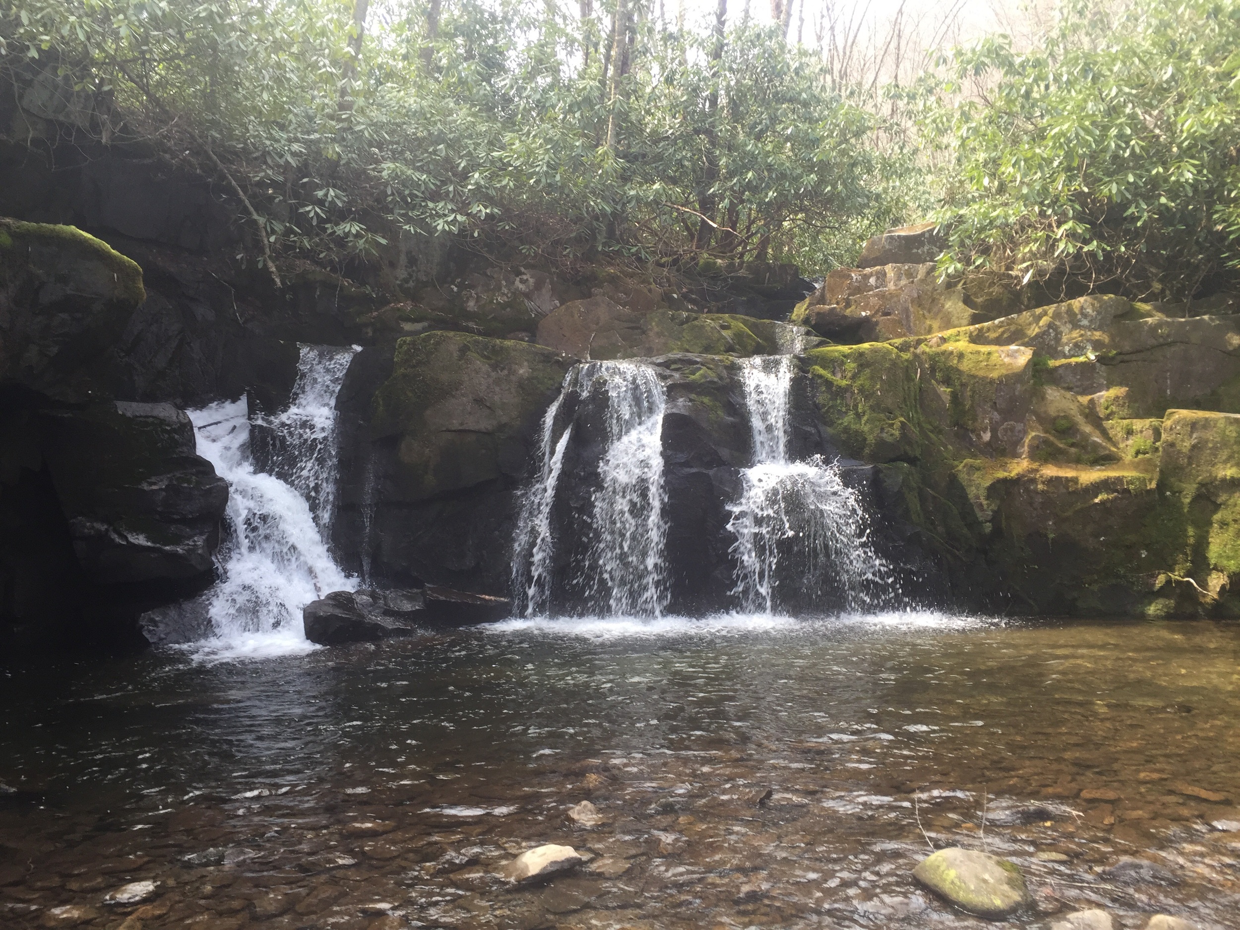
Sometimes I'm guiding a nature walk for a hotel or resort.  While these nature walks aren't strenuous or even long, by taking these groups out on a gentle walk away from the hustle and bustle of gateway towns around the park I'm showing them something they've possibly never experienced in life - and something they may never experience again.  We often get people from flatter places in the midwest or from large cities like Chicago or New York who don't make it out to the woods often.  Showing to people how much beauty you can find just beyond the concrete jungle can be such a rewarding experience. 

3) The unpredictability

It's pretty fair to say the outdoor industry is incredibly unpredictable.  Over the winter several of my hikes had to be canceled altogether due to weather-related road closures.  Sometimes my high ridgeline day hikes have to be rescheduled or even moved to a low elevation route due to thunderstorms.  Living in the mountains of East Tennessee will definitely keep you on your toes weather-wise!  Some days I'll only be scheduled for a short 2.5-hour walk only to be working an additional 8 or 9 hours due to unscheduled hiker shuttles or last-minute getaway hikes.  The unpredictable nature of my job always keeps me on my toes!

4) The Unexpected

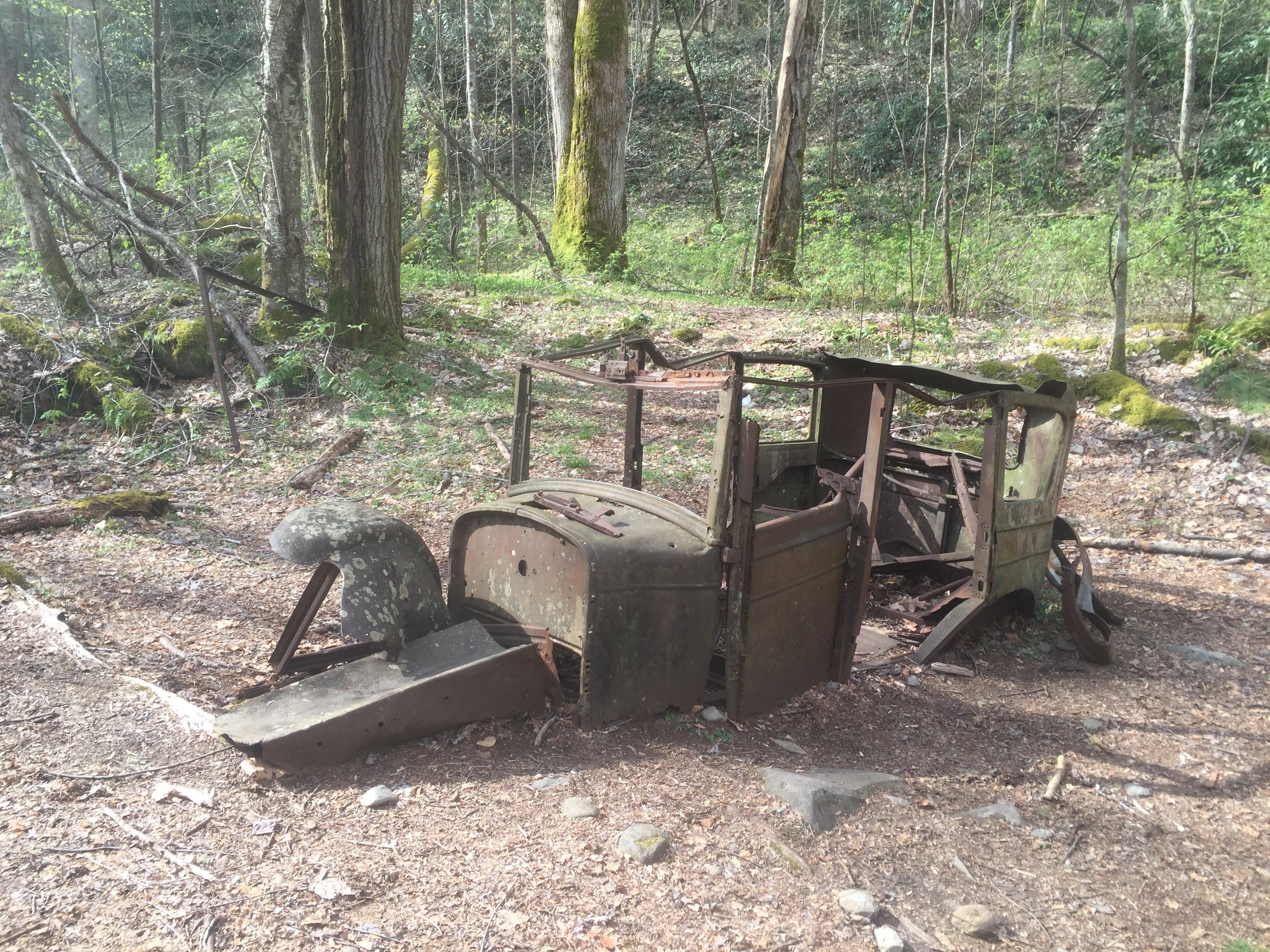
Like the weather isn't the only thing that can throw curveballs at me out in the woods!  Sometimes it can be difficult to predict how our clients will react outdoors as well.  Even though we are filling out waivers and doing health questionnaires the physical ability of our group on a hike can keep us on our toes.  I had a scheduled hike up a difficult mountain where the first two miles were faster than usual and the clients were laughing and having fun.  The next two miles up, while not any more difficult, quickly fell apart and turned into me having to decide to make the call to turn around.  It took me 11 hours to hike approximately 7.5 hours on that trip and we never did make it to the top.  The clients, however, were still happy with the hiking and the interpretation I provided during the walk so it at least helps you feel better about making a difficult call. 

5) The People

There is something incredibly satisfying about introducing yourself to a group of people you're going to see over the next several hours and knowing that you're going to be able to show them things they've never experienced before.  Even though my job relies heavily on being able to do interpretation on the things around me, I often get to know my hiking clients on a more personal level, especially on a longer day hike or an overnight trip of any length.  Getting to learn things about people on such a personal level and connect with someone on a trip is the single greatest thing about my job.  Building a close report during such a short period of time really can't be done in any other setting.  

These are just a few of the things I really love about being a hiking guide.  When I first got into guiding I had no idea what to expect but now I can honestly say that I have found where I need to be right now.  

Is your passion your career?  What is it you love about what you do?  Would you be able to work at a job that closely mirrors the hobbies you have?  

I'm linking up with CourtneyCynthia and Mar and some of the other folks who link up with us – and please don’t forget to link to your hosts if you are participating!

Indian Flats Falls - A Tuesday Adventure

My recent trek on the Appalachian Trail in Georgia may have been cut short, but I still had an opportunity to go hiking over the weekend.  My friend Shannon and I headed up the Middle Prong Trail to see Indian Flats Falls on a chilly, overcast Sunday morning.  Since Spring Break season is finally over, we are in that beautiful lull period between vacations and summertime making for an easier commute to the park, as well as for emptier trails.  This peaceful and relatively easy hike began in a nearly empty parking area and really gave us the solitude we were looking for. 

Middle Prong Trail begins at the very end of the gravel road in the Tremont section of the Smokies.  After crossing a large steel bridge, you begin following an old railroad bed up the trail at a gentle grade.  The first 3/4 of a mile on this trail follow alongside the Middle Prong of the Little River - the water on one side and rocks and downed trees on the other.  This scenic first portion of our hike had us seeing blooming doghobble, several varieties of wildflowers, and mosses growing on the rocks and decaying logs.  It was incredible peaceful walking next to the water as well.  When you hit the 0.7 mile mark on this trail there was a bench off to the left overlooking a waterfall.  The waterfall here is actually the remains of a splash dam used by the logging companies.  The trail from here turned a little bit rockier and muddier due to horse use, but still followed the same gentle grade.  Approximately 2 miles in there is a well-defined side trail off to the right where you can find an old skeleton of a Cadillac from the 1930s off in the woods.  According to local lore, the car belonged to a foreman of the logging camp.  The car quit running one day and the men of the work crew got it off the road, and pushed it to where it still remains today. 

The skeleton of a Cadillac. 

The skeleton of a Cadillac. 

After hopping back on trail from our snack break at the Cadillac, we continued up the hill through an area of old fields, once farmed by the Walker family.  A little further up we came to the site of the former CCC camp where at one time a crew of 172 men lived in the area.  These men created trails, bridges, and roads in the park during the late 1930s.  All that remains of the camp today is a brick chimney.  Now that we walked through the camp the trail begins to switchback up the hill and across a wide bridge.  At the bridge you've gone 3.5 miles from the parking area.  The trail switches back a few more times before coming to an unmarked side trail off to the right.  This is the site of Indian Flats Falls.  We took the side trail down about 0.25 miles and were treated to a serene sight - not one other person at the waterfall!  We got a few photos and took a lunch break before heading back down to our car.  After leaving the waterfall, we passed many other hikers headed up to the waterfall for the day.  We were very glad to have gotten an earlier start!

The fallen chimney of the CCC camp. 

The fallen chimney of the CCC camp. 

Indian Flats Falls. 

Indian Flats Falls. 

Indian Flats Falls is a great beginner hike here in the Smokies!  The old railroad grade makes for easy walking and everyone loves a waterfall!  Since this trail is an out-and-back hike, you'll get approximately 8 miles of hiking in.  Over the course of nearly 4 miles you gain approximately 1000 feet of elevation, so you'll barely gain 250 feet of elevation per mile.  If you want to try this hike, drive to the Tremont section of the Smokies.  Instead of turning left into the Tremont institute, go straight onto the gravel road instead.  Driving approximately 2.5 miles on this road you'll dead end into the parking area.  From here, cross the steel bridge and bear left at the fork in the trail (the right side of the fork is a nature trail).  Elevation and map for this hike are below.  

Map and elevation profile for Indian Flats Falls. 

Map and elevation profile for Indian Flats Falls. 

Have you ever hiked Indian Flats Falls?  What do you think of this area of the park? I'd love to talk with you about your favorite hikes.  Leave me a comment below or find me on Facebook or Twitter to get the conversation started!

Porters Creek Trail to Campsite #31 - A Tuesday Adventure

The Porters Creek Trail in the Smokies is well-known to locals and visitors alike in the springtime.  It's known as the wildflower hike and is popular among hikers and photographers from late winter until mid spring for the variety and beauty of the flowers growing alongside the trail.  I recently did a backpacking trip up to Campsite 31 for the night and got to enjoy all kinds of weather - from sunshine to rain to mist to sleet all in the span of about 30 hours!  Here's a recap of my recent hike on Porters Creek Trail. 

We arrived around 11 a.m. to a packed parking area at the end of the gravel road in Greenbrier.  While usually a packed trailhead means for busy hiking, we knew many hikers would be turning around before they reached our final destination for the evening.  It also was a good sign that the wildflowers were going to be extraordinary today!  Word tends to travel fast in this park about the flowers blooming, so busy trailheads mean pretty sights much of the time.  We began our walk gently uphill on the former roadbed that is the first mile of the Porters Creek Trail.  After reaching the old traffic circle, the literal end of the road, we took a detour over to the John Messer Barn and the old Smoky Mountains Hiking Club Cabin before continuing up trail.  

The flowers really look like snow covering the hillside! 

The flowers really look like snow covering the hillside! 

We got onto the more narrow foot path and kept climbing at our gentle grade, crossing a unique log bridge and walking into the section of this trail that contains the old growth forest.  Now our trees are bigger and more varied!  We turn the corner to switch back up the hill and the forest is now carpeted in gorgeous fringed phacelia!  As we are walking through and admiring the flowers we also see a few trout lillies that are just about to open.  It's been raining for a few minutes now, so the flowers are starting to wilt and close up a little.  We spot some spring beauties and continue up to the side trail to Fern Branch Falls. While here we begin to spot white trillium and even the makings of some yellow trillium.  We also spot a small patch of Dutchman's Britches.  

Fern Branch Falls in the rain. 

Fern Branch Falls in the rain. 

After a break at the waterfall most people are now turning around in the rain to head back down to their cars.  We, however, will continue uphill toward campsite 31.  We see the endemic (only found in this park) flower Fraiser's sedge along the way.  The sun begins to come out about 30 minutes from the campsite making for pleasant walking and happy campers!  We roll into the site around 5 p.m. with only two other people there for the night.  We are able to set up camp, collect water, and have dinner and a small campfire before finally calling it a night.  

Some white trillium along the trail. 

Some white trillium along the trail. 

We wake in the morning to a misty, nearly imperceptible rain falling.  We have coffee and breakfast together before finally breaking camp and heading back down trail.  The misty rainfall never stops and we even have a few periods of sleet.  At this time I sure am glad I have my new Swing liteflex umbrella keeping me dry!  I had been using it the whole trip and can even go hands-free if I need to since it attaches to the sternum strap on my pack! The rain finally let up as we reached the end of the trail and got back onto the old gravel roadbed.  We were all very happy to be close to the cars, meaning the relative warmth of our cars and hot showers at home awaited us!

The Porters Creek Trail and elevation profile

The Porters Creek Trail and elevation profile

If you want to try this hike for yourself, either as a day hike, trail run, or backpacking trip it's easy to find!  Get your campsite reservation at https://smokiespermits.nps.gov/ for campsite #31 if you want to backpack.  You'll drive to the Greenbrier entrance of the park and follow the road approximately four miles straight back to the Porter's Creek Trailhead.  Be prepared to walk a little ways if you're hiking on a weekend - parking tends to fill on beautiful weekends!  You'll follow the Porter's Creek Trail approximately 3.7 miles back to the campsite.  See the map and elevation profile below. 

Frozen Head State Park - A Tuesday Adventure

NoKey and I had a rare day off together - something that hasn't happened much lately with my marathon training schedule.  We decided that since the weather was nice and since we had a whole day we would pack up our dog and head over to Frozen Head State Park in Morgan County for a day of hiking.  Since Frozen Head is a state park, we could take our dog - which is always an issue for us when we want to hike in the Smokies.  Dogs are not allowed on trails in National Parks.  We decided to do a loop hike with the North and South Old Mac Trails, visiting a fire tower in the middle, and then afterward hiking a short out and back to a beautiful waterfall.  

When we reached the parking lot around 11:15 a.m. it was already packed. The sunny skies and nearly 70-degree temperatures brought out everyone for a day hike!  We started on the flat old road bed of the South Old Mac Trail, hiking less than a mile before running into the old CCC Dynamite Shack left from the days of this being a CCC camp.  Now our trail began the steady climb to the top!  We crossed several streams and met lots of hikers coming up and down the trail, many of them with dogs as well!  After crossing several streams and taking a few switchbacks, we came up to the old road bed at the Tub Springs Campsite.  We took a short break here for lunch, looking around the large campsite and checking out the cool spring house before taking the 0.5-mile walk up the old road to the fire tower at the top of the hill.  I stayed down with the dog while NoKey went up and took in the views!

Gracie tangling me up with her leash during our lunch break! 

Gracie tangling me up with her leash during our lunch break! 

On the way back down the trail we now took the Panther Gap Trail to the North Old Mac Trail to head back down to the car.  When we got to this shady side of the hills, we noticed there was still a beautiful dusting of snow on the hillside.  Despite several days of warmer temperatures, the shade kept it cool enough to keep it from melting!  We passed a ton of hikers and lots of kids and dogs heading up the hill on this section of the hike.  Since the hill was also in the shade, it was a bit muddier than the trail we took to the top.  I thought our dog would start to get tired or slow down on this section, but she was so full of energy her leash actually gave me a bruise as she drug me down the mountain side!  When we reached the bottom of the loop it was still relatively early so we decided to head back a little further into the park and head to the Emory Falls Trail.  

The spring house and a grill for cooking.  

The spring house and a grill for cooking.  

We were lucky enough to snag the last parking spot in the lot so we knew this trail would be even busier than the last.  The gentle grade and short distance make this hike popular!  We walked only half a mile before getting the view of our first waterfall - Debord Falls.  From here, it was supposed to only be half a mile up to Emory Falls, but we found it was closer to one mile.  The trail left the old road bed and went up on a rockier, eroded climb.  When we got to the top there were probably 50 or so people playing in the stream and photographing the waterfall.  It was nice to see so many people out and enjoying the day!  We had a quick and easy hike back out to the car. 

Emory Falls with a teeny rainbow! 

Emory Falls with a teeny rainbow! 

Frozen Head State Park is definitely my favorite place in East Tennessee to hike with my dog.  The trails are challenging, and there are close to 50 miles of trails, and you don't usually have to deal with the traffic and crowds of heading up to the Smokies.  There are also backpacking campsites and primitive front country campsites and they're all really cheap!  If you're looking to spend some time in the mountains with your dog or if you just want to get away from the traffic and noise in the Smokies, I definitely recommend Frozen Head State Park.  

Hiking with South Pole - A Tuesday Adventure

On Monday afternoon I got a message over on my Facebook page from a friend I met on my Long Trail thru hike back in the summer of 2015.  South Pole thru hiked the AT in 2015 and then, after finishing, had decided she wanted more trail.  She came back down to Vermont to finish hiking the Long Trail.  We met her near the end of our hike, in Johnson, Vermont.  She and her friend Susan were working on "marking off their maps" - a term we use here in the Smokies for people who are trying to hike all the trails in the park.  She asked if I'd like to meet them for an easy hike on Tuesday and I jumped at the chance.  Often, my job as a hiking guide has me hiking very slowly and the opportunity to hike with other endurance hikers and runners makes me happy!

We met up at the Sugarlands Visitor Center and drove off for the Twin Creeks Trail trailhead.  We got the only parking spot at the trailhead due to being out so early.  It had been raining all morning until this point, so we were happy for a break in the rain!  I brought my favorite new piece of gear, my Gossamer Gear Liteflex Umbrella, and I credit the umbrella for keeping away the rain!  We hiked up a gentle grade on the Twin Creeks Trail, only getting our feet a little wet until crossing a stream before getting to the Ogle Cabin.  This beautiful old cabin has been maintained by the park service and is easy to access from the Roaring Fork Motor Nature Trail!  We did a little bit of road walking before coming to our junction with the Old Sugarlands Trail.  

A foggy and beautiful LeConte Creek in the early morning.  The water rushing past us only moments ago came down Rainbow Falls!

A foggy and beautiful LeConte Creek in the early morning.  The water rushing past us only moments ago came down Rainbow Falls!

I've been hiking on this trail recently, so I knew to expect some muddy spots.  This old road bed comes down from the Rainbow Falls hiker parking into a valley where settlers farmed and tapped sugar maples before a CCC camp came in during the Great Depression.  We passed a few gentlemen hiking the other way who were surprised to see people out hiking in the same dreary weather they were!  We hiked downhill on the gentle grade before coming to the split in the trail where you can head up to the old cemetery and site of the famous "stone house".   We walked past and explored the old site of the CCC camp clock tower before heading back down to the trailhead.  

Susan and Sprinkles at the old CCC clock tower. 

Susan and Sprinkles at the old CCC clock tower. 

When we got back to the trailhead it was still relatively early, so we decided to hike the Gatlinburg Trail to mark it off the maps as well.  This out and back hike was very quick and lead to an 11.5 mile day completed in less than 4 hours.  

South Pole, Susan, and Me - obligatory selfie!

South Pole, Susan, and Me - obligatory selfie!

While we were out on this hike we were able to see a few wild eatables - we tasted toothwort (a horseradish-like flavor), partridge berry (a small red berry that we didn't eat due to it being close to the side of a very busy trail), and little brown jug (a heart-shaped leaf that smells and tastes like ginger or sassafras root).  We also saw a small patch of witch butter and some very vibrant turkey tail mushrooms.  We even got lucky with a big patch of blue sky making an appearance for the end of our hike!

I have hiked these three trails many times before and it's often said this is the easiest "loop" hike in the park.  If you are hiking by yourself and looking for something more than 10 miles that won't take you all day, this is a great option.  You can park at the Sugarlands Visitor Center at the park headquarters.  Walk over to Old Sugarlands Trail and hike up to the Rainbow Falls Parking area.  Follow the road down to the Bud Ogle Cabin and get on the Twin Creeks Trail.  Hike this to the road and road walk down to stoplight #8 in Gatlinburg.  Stop at a restaurant for lunch on the way if you want!  Turn left at the light and walk down to the end of Gatlinburg, where you'll hop on the Gatlinburg Trail.  Follow the Gatlinburg Trail all the way back to the visitor center parking lot.  I've included a map below for making this a loop hike, along with the elevation profile. 

Have you ever hiked these trails in the Smokies? I'd love to chat with you about your favorite hiking trails.  Please leave me a comment below or find me over on Facebook or Twitter to get the conversation started!

Sunday Runday - Week 9 of Marathon Training

Well after the difficult and tiring week I had last week, I rallied and got back on track this week.  We have had some crazy weather here in Tennessee and I think we saw three different seasons this week, but the running went very well!  Here is my weekly summary: 

Monday - 3 miles running; This was supposed to be a warm up mile, 2.5 hard effort miles, and a half easy mile with a cool down walk.  I loved doing this run!  It was sunny and warm, so how do you not like that?!

Tuesday - 11.5 miles easy hiking; a friend of mine from the Long Trail, South Pole, was in town with her friend Susan doing "map marker" hikes.  She is trying to hike all the trails in the Smokies and needs to do strange combinations of hikes to get all the miles done.  When she contacted me to see if I'd be interested in an easy hike, I jumped right on it!  We hiked Twin Creeks Trail, Old Sugarlands Trail, and the Gatlinburg Trail for 11.5 of the easiest miles in the entire park.  We even got a little bit of blue sky considering they called for rain all day.  I'll thank my umbrella for keeping the rain away :)

LeConte Creek. 

LeConte Creek. 

Wednesday - 7 miles running; for this run, I was supposed to run five comfortable miles followed by two very hard effort miles.  The wind was gusting at 30 mph, it would occasionally start raining heavy sheets of rain, and I ran this loop in an area where the sidewalks randomly end on high traffic roads.  People honked their horns at me more than usual on this run, probably because I looked like a crazy person running in the storm!  The final two hard effort miles were making my legs scream, but they were very enjoyable!

Thursday - 3 miles running; an easy recovery run was on the agenda for today. I chose to do them on the Gatlinburg Trail since I was up at the Park Headquarters for a meeting.  It was snowing throughout most of the run and the torrential storms from yesterday knocked over quite a few trees on the trail, so I got to practice my hurdle jumper skills!  Is it just me, or are the easy effort miles harder on your body? I was more sore after this run than I thought I would be!  After I got home I did a Bunny Slope workout on Youtube From Zuzka Light. 

image.jpg

Friday - REST!  I was supposed to be on an AT Shakedown hike with a client, but we had to bump the hike to next week due to bad weather and the roads being closed due to snow in the park. 

Saturday - 16 miles running; I had one of my "you must be a real runner now" moments when I didn't even feel like I hit my stride until well into my fifth mile!  From mile 5-16 I felt strong.  I ate a pack of Honey Stinger Chews and drank Nuun and I didn't feel tired, bonk, or even want to slow down.  I'm glad I finally found something that doesn't make my stomach seize up like the Gu gels do.  I also ran what my Garmin called my fastest half marathon time.  While it's not my PR, it's the fastest I've run 13.1 since December.  I ran this half for my Level Up Virtual Run - I won a free entry from Heather over at What the Heck, Why Not?  So thank you, Heather!  I can't wait to get my adorable BB8 medal in the mail!

Sunday - 10.6 miles hiking; an active rest day today and it was in the high 50s with bluebird skies all day.  We packed up our dog and drove to Frozen Head State Park (yes, where they hold the Barkley Marathons for those of you Ultra Runners out there!) where we hiked the Old Mac Trail loop and then did an out and back at Emory Falls.  It was a beautiful day and the trailheads were full.  One thing I really enjoyed about today was seeing how many people were hiking with very young children.  Lots of young kids and lots of dogs out enjoying the parks today!

image.jpg

Well, that was my week in training!  It seems like I got over my mid training slump earlier this month.  I'm still nervous about the fact that I signed up to run a freakin' marathon only about a month from now, but I'm going to stay positive!  How was your week?  Tell me all about your adventures or training in the comments below or find me over on Facebook or Twitter!

Women's Running Community

Snake Den Ridge Trail

Like most of the country, we got unexpectedly and unseasonably warm weather for most of the month of December.  Despite it being a few days after Christmas, we found ourselves itching to go hiking in the 75-degree weather - wearing shorts and t-shirts no less.  Since NoKey got a new camera for Christmas, we decided to take it for a spin on a trail with a few different and interesting things to see.  We chose the Snake Den Ridge Trail in Cosby and hiked up to the Appalachian Trail to see a plane wreckage site and an incredible view of Mt. Sterling to see the new camera in action. Snake Den Ridge Trail is not generally thought of for nice views or waterfalls or, well, really anything.  It's more of a connector trail in the park, leading you to the places you want to go. Since it was a nice weekend and right after Christmas, we chose it thinking it wouldn't be crowded with tourists and we chose right - we only saw four people the entire 12 miles we hiked.

The foot bridge near the trailhead. 

The foot bridge near the trailhead. 

We began first by walking through the closed-for-the-season Cosby Campground back to the trailhead. The beginning of this trail is an old roadbed with a gentle grade for the first 1.5 miles or so. Just before leaving the road, you'll see an old cemetery off to the right. Now that we were nice and warmed up, we were able to shed some layers before heading up to the only creek crossings on the trail - the first on a beautiful new log bridge and the second a usually easy rock hop.  The high levels of rain we got in December made this one a little tricky, but we got across relatively dry.  Snake Den Ridge Trail climbs a little more steeply for the next mile before coming to a switchback where you can take in a beautiful view of Mt. Cammerer and the Cosby valley below us. We also started to see evidence of other hikers around this point - hard boiled egg shells littered the trail for approximately the next mile or so.  Now we were at about 4000 feet in elevation and the scenery began to change - the hemlock trees gave way to spruce and the trail began to level out.  We also saw three backpackers coming down from the AT.  After climbing a huge and recent blowdown, we reached our junction with the Appalachian Trail. 

Crossing the stream. 

Crossing the stream. 

Once on the AT, we headed southbound for less than 1/10 of a mile before coming to the site of a 1984 F-4 plane crash.  The pilot slammed into the mountain and it's said that the explosion was heard as far away as Newport. After checking out the site, we headed up to the old Deer Creek Gap Helipad to soak in the views before needing to turn around.  We didn't get started hiking until 11 a.m. and it was now 2:30, so if we wanted to beat sunset, it was time to go!  When we got back down to the AT junction with Snake Den Ridge we met another dayhiker headed down the same direction we were headed.  He started all the way at Newfound Gap that morning and was headed down into the campground.  He had covered some serious mileage!  Our hike down was pretty uneventful other than the fact that during our unbridged stream crossing we both misstepped and ended up wet on one foot!

The beautiful view from the top.  The ridge line is the Benton MacKaye Trail, our first summer thru hike in 2015.

The beautiful view from the top.  The ridge line is the Benton MacKaye Trail, our first summer thru hike in 2015.

We made it back to the parking lot by 4:45 p.m. and prepped for our drive home when it began to sprinkle.  Talk about great timing!  We followed up our hike with nachos and chicken wings.  Even though we didn't have time to get in major miles for the day, we called it a victory getting in a quick 12-mile, 4400-feet elevation gain hike. 

NoKey at the top! 

NoKey at the top!