
My recent trek on the Appalachian Trail in Georgia may have been cut short, but I still had an opportunity to go hiking over the weekend. My friend Shannon and I headed up the Middle Prong Trail to see Indian Flats Falls on a chilly, overcast Sunday morning. Since Spring Break season is finally over, we are in that beautiful lull period between vacations and summertime making for an easier commute to the park, as well as for emptier trails. This peaceful and relatively easy hike began in a nearly empty parking area and really gave us the solitude we were looking for.
Middle Prong Trail begins at the very end of the gravel road in the Tremont section of the Smokies. After crossing a large steel bridge, you begin following an old railroad bed up the trail at a gentle grade. The first 3/4 of a mile on this trail follow alongside the Middle Prong of the Little River - the water on one side and rocks and downed trees on the other. This scenic first portion of our hike had us seeing blooming doghobble, several varieties of wildflowers, and mosses growing on the rocks and decaying logs. It was incredible peaceful walking next to the water as well. When you hit the 0.7 mile mark on this trail there was a bench off to the left overlooking a waterfall. The waterfall here is actually the remains of a splash dam used by the logging companies. The trail from here turned a little bit rockier and muddier due to horse use, but still followed the same gentle grade. Approximately 2 miles in there is a well-defined side trail off to the right where you can find an old skeleton of a Cadillac from the 1930s off in the woods. According to local lore, the car belonged to a foreman of the logging camp. The car quit running one day and the men of the work crew got it off the road, and pushed it to where it still remains today.
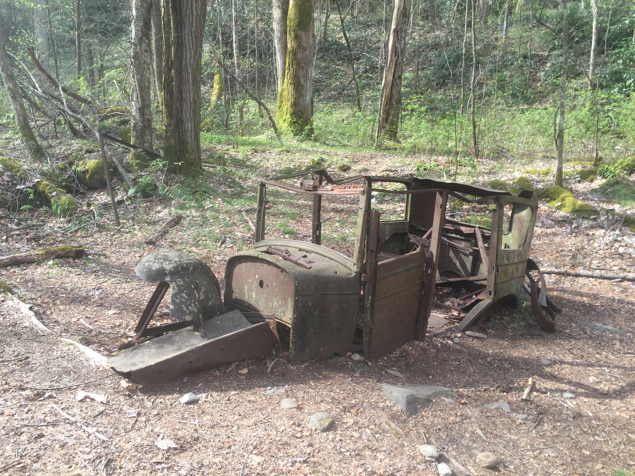
The skeleton of a Cadillac.
After hopping back on trail from our snack break at the Cadillac, we continued up the hill through an area of old fields, once farmed by the Walker family. A little further up we came to the site of the former CCC camp where at one time a crew of 172 men lived in the area. These men created trails, bridges, and roads in the park during the late 1930s. All that remains of the camp today is a brick chimney. Now that we walked through the camp the trail begins to switchback up the hill and across a wide bridge. At the bridge you've gone 3.5 miles from the parking area. The trail switches back a few more times before coming to an unmarked side trail off to the right. This is the site of Indian Flats Falls. We took the side trail down about 0.25 miles and were treated to a serene sight - not one other person at the waterfall! We got a few photos and took a lunch break before heading back down to our car. After leaving the waterfall, we passed many other hikers headed up to the waterfall for the day. We were very glad to have gotten an earlier start!

The fallen chimney of the CCC camp.
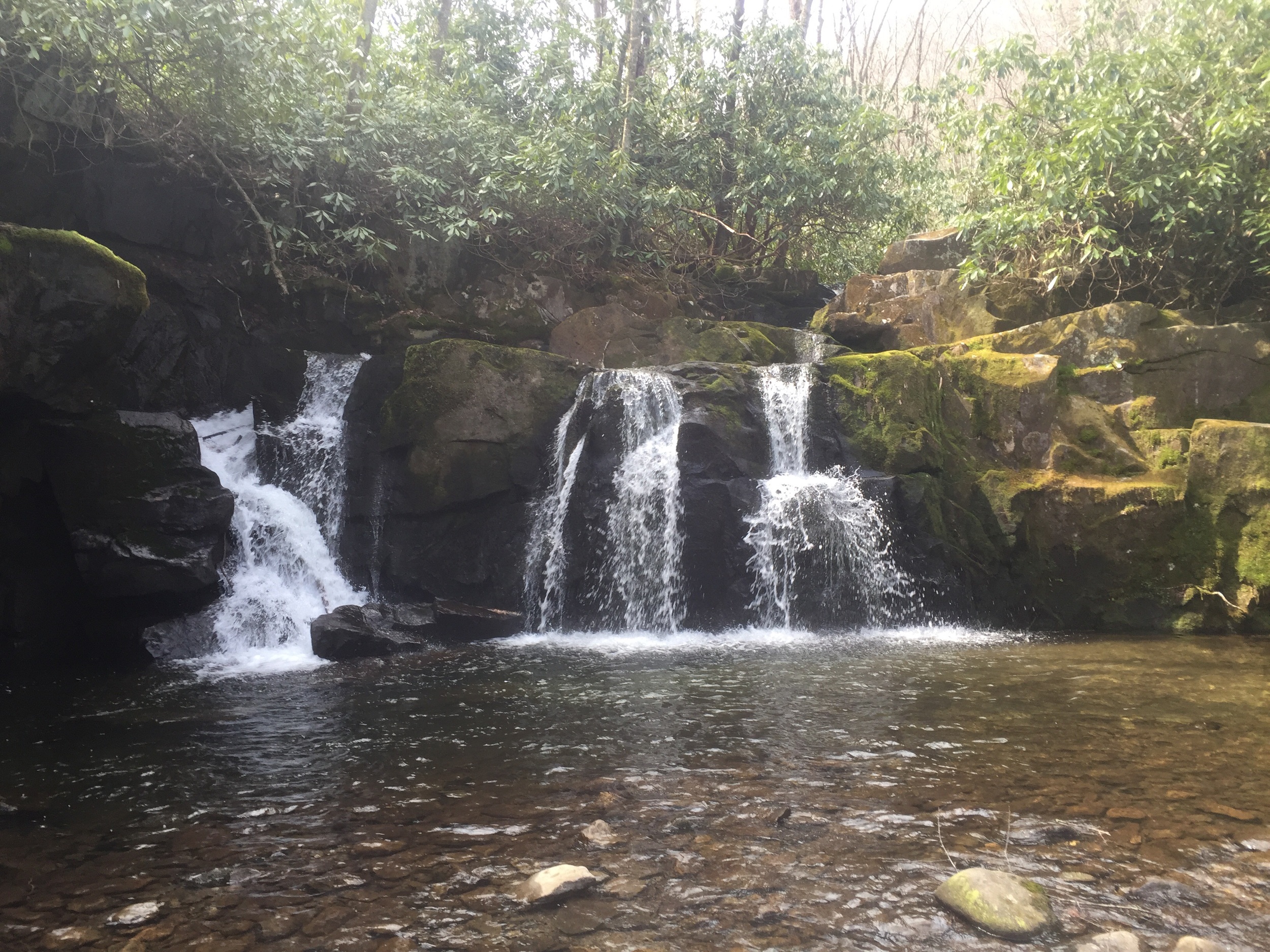
Indian Flats Falls.
Indian Flats Falls is a great beginner hike here in the Smokies! The old railroad grade makes for easy walking and everyone loves a waterfall! Since this trail is an out-and-back hike, you'll get approximately 8 miles of hiking in. Over the course of nearly 4 miles you gain approximately 1000 feet of elevation, so you'll barely gain 250 feet of elevation per mile. If you want to try this hike, drive to the Tremont section of the Smokies. Instead of turning left into the Tremont institute, go straight onto the gravel road instead. Driving approximately 2.5 miles on this road you'll dead end into the parking area. From here, cross the steel bridge and bear left at the fork in the trail (the right side of the fork is a nature trail). Elevation and map for this hike are below.

Map and elevation profile for Indian Flats Falls.