The Rich Mountain Loop hike is a classic day hike in the Smokies. Starting in the breathtaking Cades Cove, this hike is on the list of newbies and experienced hikers alike. You don't have to drive the one-way Cades Cove loop and endure the traffic, you get amazing views down into the Cove, and you hardly see many people while taking the 8.5ish mile hike. While you have a fair amount of uphill hiking to get to Cerulean Knob, the high point, this trail makes it all worth while. I recently took this hike with NoKey and my friend Shannon and we were treated to the solitude of hiking on a busy Easter weekend. Here's a recap of how our adventure went.
We met up at 9 a.m. in the parking area. We usually start later in the day, but since it was Easter Sunday we were nervous the lot would be packed with families looking to spend their holiday together in Cades Cove. Imagine our surprise when we were some of the very few people there this morning! There was a chance of thunderstorms all day and rain was forecasted at 70% chances, but we only heard one rumble of thunder in the parking area and no rain ever really materialized. We started our hike by following a muddy and eroded horse path out to the John Oliver Cabin. While headed to the cabin, we crossed a stream and found some teaberry to sample before heading over to the old homesite. The cabin had quite a few people visiting and running around, so we decided it was time to start our strenuous section and head up the mountain.
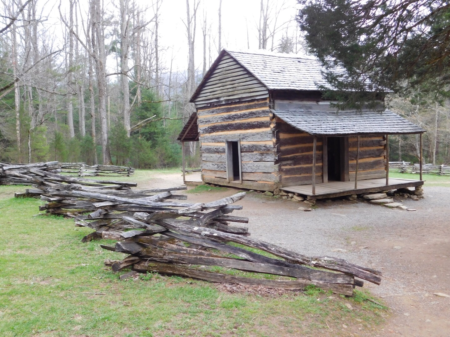
The John Oliver Cabin just before heading up hill.
From the Oliver Cabin you now begin the uphill portion of the hike. This old roadbed is rocky due to horse travel, but maintains a steady grade all the way up. We followed several streams and even saw a doe on the mountainside as we climbed. NoKey pulled ahead and Shannon and I took our time hiking uphill. We stopped halfway up at a black birch tree, where I found a stick that was fresh enough to still have some wintergreen scented oil inside. We talked about how the settlers would look for black birch (also called sweet birch) and used the branches as a natural toothbrush. The oils inside have a naturally antiseptic quality for keeping breath (and teeth!) clean. We continued upward and the trail leveled a bit as we reached the trailhead.

Hiking uphill - a woodpecker has been busy here!
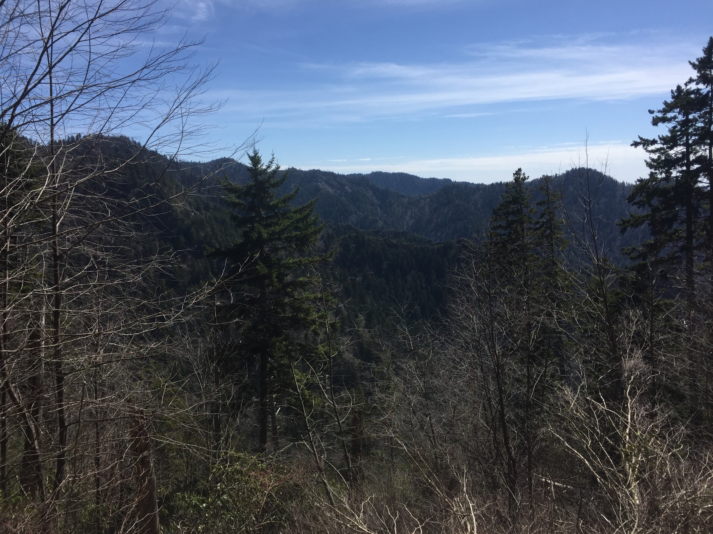
We had lunch with NoKey there, sharing some of my famous hiker crack cookies, and sent him down to do the 2.2 round-trip bonus miles on the side of Indian Grave Gap. He needed to mark it off his map and Shannon and I took an extended lunch break and took a slower pace up over to the next trailhead. While we were still headed uphill, it was much more gentle than the first part of our hike had been. I stopped to tape blisters (really! I somehow managed to get some by wearing the wrong socks!) and we headed up to Cerulean Knob. After reaching this high point of our trail, at 3685 feet, we started our descent of Scott Mountain. We took in beautiful views of the Cove through the still bare trees and started seeing more flowers - spring beauties, bloodroot, cut-leaved toothwort, pussytoes, star chickweed, and rue anemone. We were just about to reach our next trailhead and sit down to take a break and wait for NoKey when he came charging down the mountain to meet us!

Rue Anemone
We took a stretch break and an electrolytes break before we headed downhill on the steepest part of the hike. Thankfully Crooked Arm Ridge Trail has a lot of switchbacks! We carefully worked our way downhill crossing over a stream and seeing the long, beautiful Crooked Arm Cascades before meeting back up with the Rich Mountain Loop Trail and heading back to the car. Shannon thanked us for hiking with her by giving us a CASE of Thin Mint cookies. To this day, it might be the best thank you gift I've ever received! Usually I hike this trail in the winter and I'm used to being out there without there being many people. I expected today to be packed on trail, but we only saw five other hikers on the entire loop. It was a great way to escape the crowds and noise of the Cades Cove area.

Crooked Arm Cascades
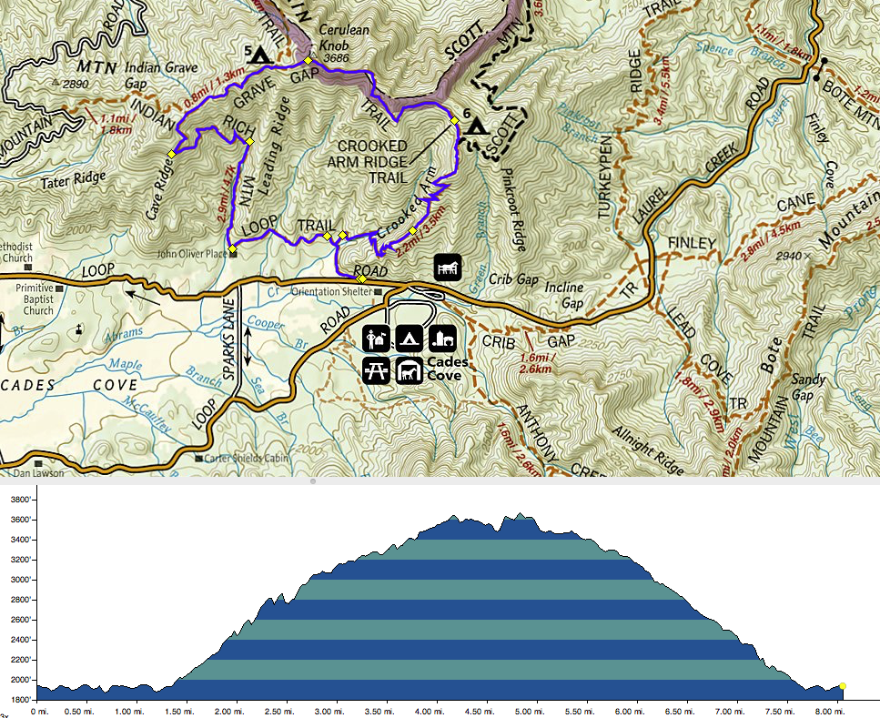
The Trail loop and elevation profile for Rich Mountain Loop.
If you want to attempt this hike on your own follow the signs into Cades Cove. Follow the road like you're going to drive the loop, however, make sure you stop at the large parking lot at the entrance for parking! The trailhead is on the right side of the road just as the road narrows to a one-way drive. You can head up either Crooked Arm Ridge Trail half a mile in or you can continue on Rich Mountain Trail. I would say most hikers go up Rich Mountain and come down Crooked Arm Ridge. Crooked Arm Ridge Trail is a little bit more eroded and strenuous on the way up.
Have you ever done this classic Smokies hike? I'd love to hear about your experience or your favorite trail in the park! Leave me a comment below or find me over on Facebook or Twitter to get the conversation started!