We are quickly approaching our one month anniversary of our finish date of the Long Trail, which signified the end of our summer of hiking. So many things have happened in the past month and we went from thinking about post-trail employment to buying a house in Tennessee and packing up all our pets and moving nearly 700 miles south. Now that the dust has settled and the boxes are unpacked, I finally have time to write some of the thoughts that often follow a long trip for me.

Caution - feelings ahead!
When I finished my AT thru hike in 2012, I wrote a blog post about my post trail feelings and it helped me to feel a little better. Here I am again, three years older and still stuck with the same general post trail blues. In my last post trail depression post, I wrote about the fear that there would always be a white blazed shape hole in my heart and I have to say it unfortunately has turned out to be true in a sense. It's not the Appalachian Trail I miss, but it is the trail in general. While I did hike three lesser known trails this year, many times with only NoKey as my company, there is a feeling one gets on a long-distance hike that you just don't get anywhere else. When long-distance hiking is your passion and the place you feel most at home, to be ripped away from it and know that it will be another 9 months or even two years before you can go home again can be absolutely heartbreaking.
A big thing that differs this time around is not having a job waiting for me. When I finished the AT, I foolishly thought I could go back to life the way it was before. I had no idea the effect a long-distance hike could have on a person. It felt like life had kept moving on without me - nothing had changed back where I lived but I had come back a different person. I went back to work doing the same job and living the same life, but that white blaze hole in my heart grew ever more painful. When I decided to change my life, uproot and move to Maine to work in a hostel in Millinocket I knew then life would never be the same. While I was doing work in an industry I loved, something was still missing. After Millinocket, we moved to Syracuse. The job prospects there were poor and I took two jobs that required little skill, talent, and a general level of "meh." For nearly two years I worked these two jobs and met some lovely people, but I was working toward my end goal - a summer hiking out on the trails, but getting some time off to come home and see my pets. While it wouldn't be one of the epic "Big Three" trails of the Triple Crown, smaller hikes would do just fine.
As luck would have it, all of these trails I hiked this summer were blazed white. While the Benton MacKaye Trail was a white diamond, it still started at Springer Mountain and that rectangle white blaze adorned it in a few places. The Finger Lakes Trail was a white blaze mostly. The Long Trail was the original white blaze. This summer, on three different trails in five different states, I was back home. Like the AT many days were not easy. Some days were hot and miserable. Some days it rained and rained and rained. Some days saw epic mileage and some saw shockingly low speed. All of these days lived on the trail were the simple days in the life of any thru hiker. You don't worry about anything but the present.
After the summer ended the physical pains of finishing a thru hike were present again. I have had to go back on glucosamine chondroitin supplements for my knee pain. The calluses on my feet are hard and sometimes painful. My cardiovascular endurance is incredibly high. My tolerance for sitting around and doing nothing is unbearable. Being back in the "real world" again also brings with it the stresses that one normally has - being unemployed and back in a smaller town has been hard on me. I spend too many hours on the computer looking for jobs and avoiding writing for some of the other blogs I write for. I've been shopping on home improvement sites trying to find projects for the new house we're living in. I've been doing everything but getting back out into the woods. It's almost as if going back to the place that brings me such joy is like rubbing salt into a very fresh and sore wound - a wound shaped like a white blaze.
I know this state I am in is only temporary, but the sadness that comes at the end of a long hike is very real and very strong for me. I'm hoping to be able to find some sort of job to get me back outdoors very soon, especially now that we are living in a place where the low temperatures in the wintertime are so much nicer than where we were living in New York. As for right now, I'll be taking life one day at a time and looking forward to my next grand adventure.

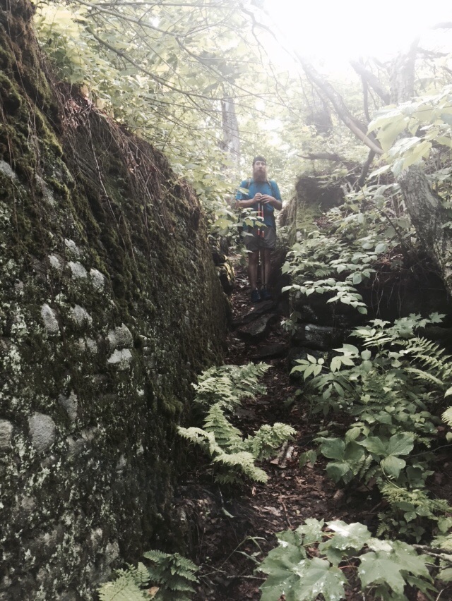
Day after day, sights like this were a comfort to me.